• Our booking engine at tickets.railforums.co.uk (powered by TrainSplit) helps support the running of the forum with every ticket purchase! Find out more and ask any questions/give us feedback in this thread!

Reopening the Ventnor Tunnel

Meerkat

Established Member
Joined
14 Jul 2018
Messages
7,619
While not the most economic option, the best bet for traffic would probably be to build a modern road tunnel next to the existing one, then bypass Wroxall to the east before linking up with the A3020 east of Whiteley Bank. Failing that I suppose you could make the Whitwell Road a dual carriageway.
Is the rail tunnel available as an emergency tunnel for a new parallel road tunnel?
I assume that as I haven’t heard of the rail tunnel collapsing it goes through pretty solid ground?
just checked contours - a Wroxall bypass will be heavily engineered and/or steep, particularly on the old railway side.
 
Sponsor Post - registered members do not see these adverts; click here to register, or click here to log in
R

RailUK Forums

MarkyT

Established Member
Joined
20 May 2012
Messages
6,290
Location
Torbay
ISTR the Norwegian city of Bergen was only reachable by rail or by sea until relatively recently, and it didn't seem to do it any harm.
And Zermatt is really on its uppers these days since never allowing private cars to become established in the town!
 

AlastairFraser

Established Member
Joined
12 Aug 2018
Messages
2,186
Is the rail tunnel available as an emergency tunnel for a new parallel road tunnel?
I assume that as I haven’t heard of the rail tunnel collapsing it goes through pretty solid ground?
just checked contours - a Wroxall bypass will be heavily engineered and/or steep, particularly on the old railway side.
Steep shouldn't be an issue except for on the financial side - look at the new A465 Heads of the Valleys road in Wales, some of the sections are an insane feat.
The rail tunnel is limited clearance, so that would possibly impact on the ability to function as an emergency tunnel.
 

yoyothehobo

Member
Joined
21 Aug 2015
Messages
555
Steep shouldn't be an issue except for on the financial side - look at the new A465 Heads of the Valleys road in Wales, some of the sections are an insane feat.
The rail tunnel is limited clearance, so that would possibly impact on the ability to function as an emergency tunnel.
The rail tunnel is in decent ground, looks like it goes through the chalk solely. It wouldnt be that challenging to build a road or road tunnel to Ventnor. Its the geological problems with Ventnor itself which are the big concern which will require much ongoing work. I cannot imagaine much money being thrown at access issues over any massive stability improvements of the town.
 

AlastairFraser

Established Member
Joined
12 Aug 2018
Messages
2,186
The rail tunnel is in decent ground, looks like it goes through the chalk solely. It wouldnt be that challenging to build a road or road tunnel to Ventnor. Its the geological problems with Ventnor itself which are the big concern which will require much ongoing work. I cannot imagaine much money being thrown at access issues over any massive stability improvements of the town.
Perhaps they could relocate some of the housing towards artificial land built out from the least nice parts of the beach.
 

bramling

Veteran Member
Joined
5 Mar 2012
Messages
17,808
Location
Hertfordshire / Teesdale
Steep shouldn't be an issue except for on the financial side - look at the new A465 Heads of the Valleys road in Wales, some of the sections are an insane feat.
The rail tunnel is limited clearance, so that would possibly impact on the ability to function as an emergency tunnel.

Probably the most useful potential purpose for the tunnel would be as a foot or cycle path, especially as there is already one on the alignment from Shanklin to Wroxall.

I’m not sure if the presence of the water pipe would be a hindrance to this though.
 

AlastairFraser

Established Member
Joined
12 Aug 2018
Messages
2,186
Probably the most useful potential purpose for the tunnel would be as a foot or cycle path, especially as there is already one on the alignment from Shanklin to Wroxall.

I’m not sure if the presence of the water pipe would be a hindrance to this though.
That's a decent idea, especially if a road tunnel was built parallel.
 

Dr Hoo

Established Member
Joined
10 Nov 2015
Messages
3,986
Location
Hope Valley
Probably the most useful potential purpose for the tunnel would be as a foot or cycle path, especially as there is already one on the alignment from Shanklin to Wroxall.

I’m not sure if the presence of the water pipe would be a hindrance to this though.
Well, there’s an important water main along the Monsal Trail in the Peak District, including through the six tunnels. Admittedly the tunnels were formerly double track and the main is to one side with the very popular shared walking, cycling, wheelchair and equestrian path through the centre.
 

cinders&ashes

Member
Joined
29 Oct 2023
Messages
32
Location
Havant
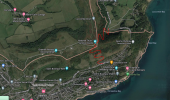
Easiest and cheapest road option - a pair of lanes connecting with Down Lane, which runs from Upper Ventnor over the downs, bypassing the troublesome areas. Neither the Upper-Lower Ventnor connection threatened by the Graben nor even Leeson Road are permanently written off but may face intermittent closure, this allows a route around for both but, with Down lane being narrow and the proposed connecting lanes on steep ground, would likely be winding single lane with passing points - as is used for many low-volume lanes. Not intended for heavy goods or full size buses but would retain some connectivity either instead of or complementing a restored rail link. Bus route would be via Whitwell if the main roads do close, same for HGVs. Likely the lanes would be hard to navigate in snow/ice and may be 4x4 only.

If Leeson Rd had a section permanently closed then, like the undercliff, the section might become bikeway which would make a nice cycling route. As the road would only be for access each end rather than through traffic, the volumes and speed limit could be low enough to make this suitable to share with cyclists.

1705064181625.png
 

AlastairFraser

Established Member
Joined
12 Aug 2018
Messages
2,186
Easiest and cheapest road option - a pair of lanes connecting with Down Lane, which runs from Upper Ventnor over the downs, bypassing the troublesome areas. Neither the Upper-Lower Ventnor connection threatened by the Graben nor even Leeson Road are permanently written off but may face intermittent closure, this allows a route around for both but, with Down lane being narrow and the proposed connecting lanes on steep ground, would likely be winding single lane with passing points - as is used for many low-volume lanes. Not intended for heavy goods or full size buses but would retain some connectivity either instead of or complementing a restored rail link. Bus route would be via Whitwell if the main roads do close, same for HGVs. Likely the lanes would be hard to navigate in snow/ice and may be 4x4 only.

If Leeson Rd had a section permanently closed then, like the undercliff, the section might become bikeway which would make a nice cycling route. As the road would only be for access each end rather than through traffic, the volumes and speed limit could be low enough to make this suitable to share with cyclists.

View attachment 150128
I doubt a local authority would invest in such a scheme, as it only fixes part of the threat of Ventnor and the vicinity being cut off from the network. I find investment in Britain, especially public investment, tends to be all or nothing.
 

yoyothehobo

Member
Joined
21 Aug 2015
Messages
555
Easiest and cheapest road option - a pair of lanes connecting with Down Lane, which runs from Upper Ventnor over the downs, bypassing the troublesome areas. Neither the Upper-Lower Ventnor connection threatened by the Graben nor even Leeson Road are permanently written off but may face intermittent closure, this allows a route around for both but, with Down lane being narrow and the proposed connecting lanes on steep ground, would likely be winding single lane with passing points - as is used for many low-volume lanes. Not intended for heavy goods or full size buses but would retain some connectivity either instead of or complementing a restored rail link. Bus route would be via Whitwell if the main roads do close, same for HGVs. Likely the lanes would be hard to navigate in snow/ice and may be 4x4 only.

If Leeson Rd had a section permanently closed then, like the undercliff, the section might become bikeway which would make a nice cycling route. As the road would only be for access each end rather than through traffic, the volumes and speed limit could be low enough to make this suitable to share with cyclists.
This is neither easy nor cheap.

You want to build a new road on the surface across National Trust owned land. You also want to gain nearly 150m of elevation in just over 300m horizontal distance. Even with switch backs that would be insane and would look hideous.

I think the best Ventnor could really hope for is improvements to the access from Wroxhall.

If the road to Shanklin is abandoned/permanently closed it will be for cycle access only following that.
 

Meerkat

Established Member
Joined
14 Jul 2018
Messages
7,619
The rail tunnel is in decent ground, looks like it goes through the chalk solely. It wouldnt be that challenging to build a road or road tunnel to Ventnor. Its the geological problems with Ventnor itself which are the big concern which will require much ongoing work. I cannot imagaine much money being thrown at access issues over any massive stability improvements of the town.
No point in stabilising the town if you can't get to it, and harder to build anything if you can't truck stuff in along the A-road.

Though you have given me a bizarre image of them tunnelling from the north and as they break through finding the vibrations have made the town slide away....
 

AlbertBeale

Established Member
Joined
16 Jun 2019
Messages
2,780
Location
London
ISTR the Norwegian city of Bergen was only reachable by rail or by sea until relatively recently, and it didn't seem to do it any harm.

And Zermatt is really on its uppers these days since never allowing private cars to become established in the town!

And a couple of the little towns in the Cinque Terre in Liguria have only rail and sea access... they're not doing badly...
 

SynthD

Member
Joined
4 Apr 2020
Messages
1,172
Location
UK
The road to Bergen was made in 1937. The Cinque Terre group are all connected to the road network, but not direct from town to town. Zermatt has multiple roads on solid ground to the rest of Switzerland, but with limited permission to use them.
 

MarkyT

Established Member
Joined
20 May 2012
Messages
6,290
Location
Torbay
OK here it is then, the ultimate solution and please don't judge me harshly, its just a wild flight of fantasy!

My suggestion is a short section of new rack-equipped track beyond the tunnel portal, diving sharply under Ocean View Rd and emerging at a new terminus in The Grove car park, handy for the town centre level. I wouldn't adapt the D trains to full rack operation save adding a pinion to one trailing axle of each car to ensure it can always hold itself on the rack section. For the descent I propose a 'rack slug' locomotive with a low hood and no cab that the existing train can buffer up to and control, the driver being able to see over the unit's low body. The slug would be full of batteries to keep it firmly on the rails. Thus it will be able to harvest energy from controlling the descent to assist in the subsequent ascent without taxing the traction supply too heavily. Alternatively, a rope-hauled slug for the incline might be used like the Opicina Tram In Trieste, Italy, although in the Ventnor case with one slug, not a balanced funicular. Looks like a 50m drop in about 500m so at 1 in 10ish probably acceptable without stepped-floor cars. There would have to be a stop at the top to ease up to the 'moving buffer stop' so that might as well also be a public stop for people at the top of the hill and a car park and drop off. The guard would no doubt announce the imminent descent with advice to be seated etc.
 

AlastairFraser

Established Member
Joined
12 Aug 2018
Messages
2,186
OK here it is then, the ultimate solution and please don't judge me harshly, its just a wild flight of fantasy!

My suggestion is a short section of new rack-equipped track beyond the tunnel portal, diving sharply under Ocean View Rd and emerging at a new terminus in The Grove car park, handy for the town centre level. I wouldn't adapt the D trains to full rack operation save adding a pinion to one trailing axle of each car to ensure it can always hold itself on the rack section. For the descent I propose a 'rack slug' locomotive with a low hood and no cab that the existing train can buffer up to and control, the driver being able to see over the unit's low body. The slug would be full of batteries to keep it firmly on the rails. Thus it will be able to harvest energy from controlling the descent to assist in the subsequent ascent without taxing the traction supply too heavily. Alternatively, a rope-hauled slug for the incline might be used like the Opicina Tram In Trieste, Italy, although in the Ventnor case with one slug, not a balanced funicular. Looks like a 50m drop in about 500m so at 1 in 10ish probably acceptable without stepped-floor cars. There would have to be a stop at the top to ease up to the 'moving buffer stop' so that might as well also be a public stop for people at the top of the hill and a car park and drop off. The guard would no doubt announce the imminent descent with advice to be seated etc.
Sounds like something off a Dahir Insaat video, but I admire the detail you've gone to in engineering such a line.
 

MarkyT

Established Member
Joined
20 May 2012
Messages
6,290
Location
Torbay
Sounds like something off a Dahir Insaat video, but I admire the detail you've gone to in engineering such a line.
Oh to have the skills to produce such high-quality computer-generated presentations, although I would say their ideas illustrated are usually far wilder and far-fetched than mine here, and sometimes disturbing!
 

cinders&ashes

Member
Joined
29 Oct 2023
Messages
32
Location
Havant
OK here it is then, the ultimate solution and please don't judge me harshly, its just a wild flight of fantasy!

My suggestion is a short section of new rack-equipped track beyond the tunnel portal, diving sharply under Ocean View Rd and emerging at a new terminus in The Grove car park, handy for the town centre level. I wouldn't adapt the D trains to full rack operation save adding a pinion to one trailing axle of each car to ensure it can always hold itself on the rack section. For the descent I propose a 'rack slug' locomotive with a low hood and no cab that the existing train can buffer up to and control, the driver being able to see over the unit's low body. The slug would be full of batteries to keep it firmly on the rails. Thus it will be able to harvest energy from controlling the descent to assist in the subsequent ascent without taxing the traction supply too heavily. Alternatively, a rope-hauled slug for the incline might be used like the Opicina Tram In Trieste, Italy, although in the Ventnor case with one slug, not a balanced funicular. Looks like a 50m drop in about 500m so at 1 in 10ish probably acceptable without stepped-floor cars. There would have to be a stop at the top to ease up to the 'moving buffer stop' so that might as well also be a public stop for people at the top of the hill and a car park and drop off. The guard would no doubt announce the imminent descent with advice to be seated etc.
A funicular was what Ventnor needed to complement the railway. Now, a town bus service would do fine - just like Shanklin has the Shanklin Steamer.

This is neither easy nor cheap.

You want to build a new road on the surface across National Trust owned land. You also want to gain nearly 150m of elevation in just over 300m horizontal distance. Even with switch backs that would be insane and would look hideous.

I think the best Ventnor could really hope for is improvements to the access from Wroxhall.

If the road to Shanklin is abandoned/permanently closed it will be for cycle access only following that.
Maybe as I drew it but that would only also be if all 3 met in the same place. The point is to build on more stable ground. The Leeson and Shanklin roads could meet ~halfway up with more gradual routes, then a further junction and climb to connect that road to Down Ln.
 

AlastairFraser

Established Member
Joined
12 Aug 2018
Messages
2,186
Oh to have the skills to produce such high-quality computer-generated presentations, although I would say their ideas illustrated are usually far wilder and far-fetched than mine here, and sometimes disturbing!
Hahahaha indeed
 

cinders&ashes

Member
Joined
29 Oct 2023
Messages
32
Location
Havant
Indeed this is exactly what was proposed when the railway line was under construction. I may even have mentioned this in an earlier post on this thread.
sorry, thought you were referring to a trio of cable cars? This would also have worked, but wouldn't want to be on that in bad weather lol.
 

Railway21

New Member
Joined
2 Apr 2024
Messages
1
Location
New Milton
A new road and tunnel through St Boniface Down would cost vastly more than reopening an existing tunnel and alignment, and would have traffic bottlenecks in Wroxall anyway.
All the line needs is a new bridge at Shanklin and changes to road layout in Wroxall where the alignment has been built over.


Parking on Ocean View Road is for residents. There are no driveways and the backs of the houses don't reach on to other roads with parking.
If you're coming from Wroxall and possibly Whitwell you'd take that route


Ventnor is a town of 6000 with a further 1800 in Wroxall on a 4 mile line. Both have tourist accommodation and attractions and Ventnor has beaches popular with tourists and islanders alike.
The bus takes ages to get to Ryde, train would be about 2/3 of the time.
With last month’s landslip at Bonchurch and emergency roadworks on Ocean View Road in Ventnor blocking 2 of 3 access roads into the town, a local resident shares his view on what could be next for Ventnor, with a suggestion of restoring the railway line into the town.


Up until now, I’ve always assumed the Ventnor Tunnel can never be used for transport purposes again, but with the recent landslips and climate change making extreme weather more likely, it is a matter of time before something will have to be done to ensure Ventnor isn’t cut off from the rest of the Island. Reopening the the tunnel would probably be the most practical option as the infrastructure is already there, while the water pipe can always be moved. Restoring the railway from Shanklin makes the most sense although I’m also wondering if the tunnel could be compatible for road traffic as another option?

It is my understanding that the Ventnor tunnel was bored through decent quality chalk

The land where the original station stood could still be utilzed once more and the original line re-established . The problem is the cost which will need to be funded by government money. NEVER has the Isle of Wight council had a stronger case to argue for the restoration of this railway line with not only the main road to Shanklin likely closed now forever plus the other major road to west wight , military road when viewed via google seeming an accident waiting to happen as there is a near 80 degree. 150 ft plus drop being mere yards away from the edge of the road. In bad weather or due to reckless driving some poor person/s could now be driven or drive off that cliff edge. So Military Road will also get closed soon.

Then there are the new cracks in the main road between lower and upper Ventnor , where the Graben is once again having its way.

It should be argued that within a few years a railway link could be the only connection between Ventnor and the rest of the IOW

Doing nothing could result in many businesses and workers in those businesses going bust, and Ventnor becoming a ghost town
 

Meerkat

Established Member
Joined
14 Jul 2018
Messages
7,619
It is my understanding that the Ventnor tunnel was bored through decent quality chalk

The land where the original station stood could still be utilzed once more and the original line re-established . The problem is the cost which will need to be funded by government money. NEVER has the Isle of Wight council had a stronger case to argue for the restoration of this railway line with not only the main road to Shanklin likely closed now forever plus the other major road to west wight , military road when viewed via google seeming an accident waiting to happen as there is a near 80 degree. 150 ft plus drop being mere yards away from the edge of the road. In bad weather or due to reckless driving some poor person/s could now be driven or drive off that cliff edge. So Military Road will also get closed soon.

Then there are the new cracks in the main road between lower and upper Ventnor , where the Graben is once again having its way.

It should be argued that within a few years a railway link could be the only connection between Ventnor and the rest of the IOW

Doing nothing could result in many businesses and workers in those businesses going bust, and Ventnor becoming a ghost town
If rail is the only link then Ventnor dies. It must have a safe road link to survive
 

WAO

Member
Joined
10 Mar 2019
Messages
666
IIRC, Ventnor has declined considerably relative to Sandown and Shanklin since losing the railway in 1966. It could have been saved if the Local Authority had provided the extra cost above BR's limited budget. This would have been borrowed over a long period, only slightly increasing the Rates. True, Ventnor provided fewer customers (it was after all at the end of the line) than other stations, at that time. Local governmet both in 1966 and subsequently in failing to protect in planning (and by acquisition if necessary) the route from encroachment bears the blame.

What might have Ventnor become with its spectacular views had it had the same volume (rail) access as its northern neighbours?

WAO
 

Doomotron

Member
Joined
25 Jun 2018
Messages
1,188
Location
Kent
Is it a problem? Yes. Does it justify the prohibitively expensive cost of rebuilding the railway, as discussed at length in this thread? I really doubt it.
 

bramling

Veteran Member
Joined
5 Mar 2012
Messages
17,808
Location
Hertfordshire / Teesdale
IIRC, Ventnor has declined considerably relative to Sandown and Shanklin since losing the railway in 1966. It could have been saved if the Local Authority had provided the extra cost above BR's limited budget. This would have been borrowed over a long period, only slightly increasing the Rates. True, Ventnor provided fewer customers (it was after all at the end of the line) than other stations, at that time. Local governmet both in 1966 and subsequently in failing to protect in planning (and by acquisition if necessary) the route from encroachment bears the blame.

What might have Ventnor become with its spectacular views had it had the same volume (rail) access as its northern neighbours?

WAO

The problem is it never really had the same rail access as Shanklin and Sandown, as both Ventnor stations were always very unfavourably sited. Had this not been the case it’s highly likely the Ryde to Ventnor line would still be open in entirety today.

Personally my view is that given the short distance from Shanklin to Ventnor it should probably have been retained, but it wasn’t and we are where we are. And of course it’s easy to say this when not having to account for the costs of extending the electrification to Ventnor, which would have imposed a cost which may well have wrecked the case for the whole scheme.
 

DanNCL

Established Member
Joined
17 Jul 2017
Messages
4,324
Location
County Durham
the main road to Shanklin likely closed now forever
Not necessarily the case. Monitoring equipment is in place, if there’s no Earth movement for six weeks the road will be considered for reopening. That was five weeks ago so an announcement either way should presumably be made in the next week or two.
 

cinders&ashes

Member
Joined
29 Oct 2023
Messages
32
Location
Havant
IIRC, Ventnor has declined considerably relative to Sandown and Shanklin since losing the railway in 1966. It could have been saved if the Local Authority had provided the extra cost above BR's limited budget. This would have been borrowed over a long period, only slightly increasing the Rates. True, Ventnor provided fewer customers (it was after all at the end of the line) than other stations, at that time. Local governmet both in 1966 and subsequently in failing to protect in planning (and by acquisition if necessary) the route from encroachment bears the blame.

What might have Ventnor become with its spectacular views had it had the same volume (rail) access as its northern neighbours?

WAO
Yeap, in hindsight even preserving the route and sites would have made it more viable. As someone who lived in Ventnor from 1979 through 1995 I saw its relative decline vs Sandown and Shanklin. I actually did my very first driving lessons with my dad on the industrial estate that sits on the station site when the units were closed on Sundays, living on the road near the station.
The town had started reinventing itself as an all year round destination with fringe-type events etc, rather than relying on the dying bucket n' spade market, but the pandemic and then these roads issues have dealt savage blows.

The problem was that the IWCC saw dollar signs when the RYR programme launched and asked for not one but two completely reopened lines. RYR already favours heritage/freight lines being restored to passenger service, or simply station reopenings, rather than laying new track, so they should stayed laser-focussed and just asked for the Ventnor extension with development at Smallbrook Jn to turn it into a proper station for IL and a terminus for IWSR.

Yes, Ventnor station some way above the town/breach, but Shanklin station is some way above the beach and far from the popular Old Village/Chine area - they rely on a town bus and so would Ventnor, not rocket science. Add in bike parking/charging and a taxi/pickup rank and it'd get plenty of use.
 

Top