• Our new ticketing site is now live! Using either this or the original site (both powered by TrainSplit) helps support the running of the forum with every ticket purchase! Find out more and ask any questions/give us feedback in this thread!

2050 Manchester Bee Network Map

Status
Not open for further replies.

GJMarshy

Member
Joined
28 Aug 2023
Messages
116
Location
Manchester
Thought this might be of interest to some on here!

This map is a mix of my design passion and a vision for where I think Manchester’s transport system should be heading over the next 30 years. It’s not meant to capture every pipeline project or all of my own ideas, but instead highlights what I think are the “best performers.” These are the projects that, in my view, would deliver the most value in terms of connectivity, ridership growth, and future-proofing the network.

Key Features:

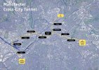
1. Cross-City Metro Tunnel


One of the central features is a proposed cross-city metro tunnel, linking the East Didsbury line (extended to Stockport) and Altrincham line to Piccadilly and the Bury line. This would effectively replace Metrolink services on these routes with frequent heavy rail metro. The goal here is to fully utilise the tunnel’s capacity and ensure it’s ready for future ridership growth, with the potential for expansion into Tameside as population density increases.

2. South Manchester Tram Line

The map also includes a new tram line connecting the Airport Metrolink line to Piccadilly via South Manchester, with stops in Moss Side, Whitworth Park, MRI, and the Universities. These areas are currently under-served by rail-based transit, and this line would help address that. The route is intentionally a bit indirect toward the city centre, because trams excel at short, high-demand trips. This line encourages exactly that, while also acting as a feeder into the metro and rail network for longer journeys. It also ensures the Airport/Wythenshawe line stays well-connected, since the East Didsbury line would become metro-only under this proposal.

3. New Tram and Rail Connections
  • There’s a new tram line linking Bury and Heywood to the Rochdale Metrolink line.
  • I’ve also proposed a rail spur off the Calder Valley line, terminating at Middleton. To me, this feels like a much more practical way of connecting Middleton to the city centre than a slow, winding tram route.
I’ve also added a few new commuter rail stations, which I think could really improve the system:
  • Middleton Junction
  • Longsight
  • United (relocated)
  • Cornbrook, to improve rail-tram interchange
  • Oldfield Road, designed to boost North-South Manchester connectivity, as well as links to Salford Quays, without having to go through the city centre. This one could even work as a Northern Powerhouse Rail (NPR)station on an east-west alignment.

Design Philosophy

For the map itself, I really wanted to convey:
“This is Manchester. This is the future.”
It includes geographical landmarks like the River Irwell and Salford Quays’ basins to give it a strong sense of place, while keeping geographic distortions to a minimum. I wanted it to feel rooted in Manchester, but still readable and usable even at smaller sizes. Striking that balance was tricky, and I’ll admit it’s not perfect—there are areas I’d like to refine, like extending detail beyond some of the directional arrows. But after a lot of trial and error, this is where I landed, and I think it works pretty well.

It’s bold. It’s a little different. But I hope it conveys the ambition and practicality of the world-class transport system Manchester deserves—and is on its way to building. I’m quite happy with the result, but as with everything, always room for improvement. Let me know your thoughts!

— Marshy
 

Attachments

  • 1-2.jpg
    1-2.jpg
    2.8 MB · Views: 212
Sponsor Post - registered members do not see these adverts; click here to register, or click here to log in
R

RailUK Forums

Mcr Warrior

Veteran Member
Joined
8 Jan 2009
Messages
14,535
Not sure if the many users of Metrolink tram services from Altrincham/Timperley would want to see journey times into Central Manchester extended by a magical mystery tour of Salford Quays/Ordsall/Oldfield Road.
 

GJMarshy

Member
Joined
28 Aug 2023
Messages
116
Location
Manchester
The very small size of the typeface of the name of the railway stations provided by the attachment when clicked upon is very hard to read.

Yeah font size was a tricky one! The remit I set myself was that it should match the font size of the pocket tube map when opened out fully, which this does. Although I'll admit viewing it on your average PC/Laptop screen will be tricky without zoom! It's a fine balance, maybe taking your pint there's something to be Sid for making "Major" station fonts slightly larger?

@Farigiraf
Interesting that you've proposed closing Ardwick. Any reason why it couldn't just be upgraded and given a regular service?

As the station is so awkwardly sited (access is only possible from the NE), new developments have turned their back on it (severing potential connections to the south), and given passenger numbers it might be wise to close. You might notice I've replaced it with "Ardwick" tram stop (close to Ardwick Green) serving the area directly, as well as "Piccadilly East" (metro) at the end of Fairfield Street. Combined, both should much better-serve the area and increase TOD potential.

@Mcr Warrior Not sure if the many users of Metrolink tram services from Altrincham/Timperley would want to see journey times into Central Manchester extended by a magical mystery tour of Salford Quays/Ordsall/Oldfield Road.

It's actually a little more direct than it appears on the map! In fact when taking into account stop spacing,60kph top speeds & 20 second dwell times, it gives 5.mins 30 seconds from Old Trafford to St. Peter's Square. This compares with 12mins on the same tip by Metrolink tram today!

Cross-City Tunnel.jpg
 

Rail Quest

Member
Joined
8 Apr 2023
Messages
507
Location
Warrington
Really interesting read, this. An easily identifiable challenge for the lot is, of course, funding. The proposed South Manchester tram line is potentially where I see the biggest problems arising. Given the proposal to cut off the existing Airport line as a result of the East Didsbury/Stockport Metro, you'd have to build the new tram line first to prevent having to run the Airport/Wythenshawe services in isolation. With that tram line running through incredibly densely populated areas on the Manchester end without any existing cutting to use, one would have to fund all of that and then somehow convince the government of the time to invest billions more into a Pic/Vic Tunnel-style scheme to turn a good chunk of the existing infrastructure into a Cross Rail of the North.

I think it would be an amazing transport system if this is what it looked like, I just doubt how realistic it is - the kind of thing I spend my days dreaming of :lol:
 

Trainguy34

Member
Joined
29 Apr 2023
Messages
941
Location
Kent
Looks good, maybe on the Stockport - Altrincham Train, stops at Wythenshawe and Timperley could be useful going off Google Maps, looks of capacity will be needed by 2050, so probably needed.

Edit: Also some of the Tram Line numbers don't look to be correct, primarily around Media City/Trafford Centre and Rochdale/Bury.
 
Last edited:

Trainguy34

Member
Joined
29 Apr 2023
Messages
941
Location
Kent
Looks pretty good, just need a tram only version for side by side comparisons.

Edit: I might do one actually when I've got time, what did you use to create this @GJMarshy ?
 

Howardh

Established Member
Joined
17 May 2011
Messages
9,102
Even in speculation by 2050 still a huge gap in services between Bolton and Bury! It could be filled almost immediately with a 471x very limited stop - at least during the day. South Bolton (the Farnworth/Highfield area) again has nothing, when the could be a guided bus link to the V1 network (or even trams to Eccles using a lot of the old line??).

By 2050 will the current East Lancs Rail be taken over by one of heavy/light rail or trams, would make sense if the line towards Rochdale becomes trams although that would leave two stations in Bury for trams (Bolton St and the Interchange)?

I don't think the guided bus network is shown on that very interesting map?
 

deltic

Established Member
Joined
8 Feb 2010
Messages
3,480
All it needs are some orbital routes like London's highly successful Overground outer circle route.
 

Mcr Warrior

Veteran Member
Joined
8 Jan 2009
Messages
14,535
It's actually a little more direct than it appears on the map!
What track mileage (or km) have you estimated for Old Trafford to St. Peter's Square (via Salford Quays / Ordsall / Oldfield Road)? The current Metrolink route (via Cornbrook) is something like 4.016 km (2.5 miles).
 

Topological

Established Member
Joined
20 Feb 2023
Messages
1,854
Location
Swansea
Does the proposed exit point from the tunnel in the north fit in with the various Red Bank developments?

The tunnel certainly takes in all the major development sites of Manchester.

However, IF I was working out a tunnel route I would have gone for a Salford through the Quays and Ordsall then New Jackson Street and swing in via an Oxford Road stop. The line would then split for Piccadilly and Victoria at a triangle as you have it. However, the Victoria part would be phase 2 of my proposal. The tunnel would serve CLC and Atherton line trains to the West.
 

GJMarshy

Member
Joined
28 Aug 2023
Messages
116
Location
Manchester
What track mileage (or km) have you estimated for Old Trafford to St. Peter's Square (via Salford Quays / Ordsall / Oldfield Road)? The current Metrolink route (via Cornbrook) is something like 4.016 km (2.5 miles).

5.4km from OT to SPSq, so an extra 1.4km over the existing route, but taking half the time given the 80kph top speed, with an average speed still a great deal higher than the trams, especially when taking into account full grade-separation. So really that 1.4km detour is very much worth it to drive ridership whilst still achieving faster timings than the tram.

@Topological Yes so just North of the planned developments where the disused viaduct is. (Partial demolition would be required to allow for an appropriate vertical gradient)
 

Topological

Established Member
Joined
20 Feb 2023
Messages
1,854
Location
Swansea
I appreciate it is probably a function of the mapping software, but is the idea to close Market Street Metrolink?
 

GJMarshy

Member
Joined
28 Aug 2023
Messages
116
Location
Manchester
I appreciate it is probably a function of the mapping software, but is the idea to close Market Street Metrolink?

In my personal opinion yes! The area is already intensely overcrowded, with tram/pedestrian incidents in the area happening regularly. The metro would reduce the dependance on direct Picc-Vic connections since Oldfield Road (Access directly via Castlefield as well as the Metro & future NPR) would take all those services, essentially taking the city's 2nd station title.

This should mean that the 2nd city crossing (a much less trafficked route by pedestrians) would take all the St Peter's Square to Victoria & Oldham/Rochdale flows. The metro retains good connections for the vast majority of GM (and those connecting from outside)

You tend to find most arriving at Piccadilly or Victoria walk to Market Street anyway as it's such a short walk. Its main purpose is serving people living on the Metrolink branches feeding into it. The metro would effectively do the same.
 

Topological

Established Member
Joined
20 Feb 2023
Messages
1,854
Location
Swansea
Also no conversion of the Atherton line to Metrolink. A conversion might balance more of the trams through the proposed Salford Central (New Bailey) route out of Manchester. Presently, you have Eccles and Salford Quays feeding two Metrolink routes to the city.

I would have kept Market Street and Shudehill because they also offer resilience on the city centre crossings. Removing them seems like an unnecessary expense.
 

Bevan Price

Established Member
Joined
22 Apr 2010
Messages
7,804
Rather than your line through Ardwick, etc., I would put a Metrolink tram line straight down Oxford Road & Wilmslow Road past the University & Halls of Residence areas eventually meeting the East Didsbury line at Didsbury Village. Huge traffic potential for student traffic, and much faster than the parallel bus routes.

I would also suggest a Radcliffe to Bolton tram route, enabling Manchester to Bolton trams.

In the very long term and outer -ring tram route, Oldham - Ashton - Hyde - Stockport tram route might have potential.
 
Status
Not open for further replies.

Top