StephenHunter
Established Member
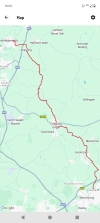
How long does it take to do 24 miles? It takes me around four hours to do eight, including lunch.
That took me seven hours and 45 minutes, so marginally over 3mph.How long does it take to do 24 miles? It takes me around four hours to do eight, including lunch.

It has been rebranded. I visited the Wirrall last weekend and walked a small section of the coast path and noticed new signage was in place which is very welcome because the last time I was there the signage was somewhat lacking.I noticed today that the England Coast Path appears to have been rebranded the King Charles III England Coast Path. Is this a belated April Fool’s thing or a case of toadying of the worst kind? No I’m not anti monarchy per se but is this sort of thing really necessary or somebody wanting recognition in the next new year’s honours list?
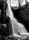
View attachment 177903

")
I find paper maps rather fiddly to use myself.Although I have an OS Map subscription I love paper maps.
I’m currently planning some walks & cycle rides for a week we are spending at Chelmorton near Buxton in July. I dug out my old, but well used Ordnance Survey Landranger 1:50000 Buxton, Matlock & Dovedale plus the Outdoor Leisure 1:25000 White Peak Area maps.
Imagine my surprise when I realised that Carsington Water wasn’t on either of them! Bearing in mind construction began in 1979 and completed in 1991 it’s time for new maps I think


.jpg")
.jpg")
.jpg")
.jpg")