• Our booking engine at tickets.railforums.co.uk (powered by TrainSplit) helps support the running of the forum with every ticket purchase! Find out more and ask any questions/give us feedback in this thread!

Derailment near Grange Over Sands

Status
Not open for further replies.
Joined
3 Mar 2020
Messages
381
Location
Furness
Worth pointing out that comparison of maps from pre digital to 21st century ones isn't straightforward. Sometimes for example things 'move' just because they were plotted in a different place using methods on the ground as opposed to areal photos from a plane or satellite or drone or whatever. I've noticed this with field boundaries and location of trees.
 
Sponsor Post - registered members do not see these adverts; click here to register, or click here to log in
R

RailUK Forums

Joined
28 Oct 2017
Messages
44
Entirely speculative, but there have been multiple mentions of a blocked culvert, and higher than usual land side water levels.

If the culvert blocked because it started to collapse, and the track bed was filled back in (this may have been quite gradual), then unblocking the culvert (large water height difference on an unusually low tide?) could then sweep a lot of material away and out to sea quickly, having seen what a defective drain managed to remove from the road outside my house (down the drain, literally).
 

mbonwick

Established Member
Joined
26 Oct 2006
Messages
6,262
Location
Kendal
Entirely speculative, but there have been multiple mentions of a blocked culvert, and higher than usual land side water levels.

If the culvert blocked because it started to collapse, and the track bed was filled back in (this may have been quite gradual), then unblocking the culvert (large water height difference on an unusually low tide?) could then sweep a lot of material away and out to sea quickly, having seen what a defective drain managed to remove from the road outside my house (down the drain, literally).
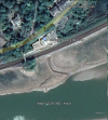
The culvert wasn't blocked because it started to collapse, but because the tides have pushed too much silt up against the outfall. The outlet in question is somewhere under the pool of water in @strawberryline 's image in post #141 above.
The pump pipes were dropped into the same marsh channel in the hope that they'd shift some of the silt which the EA won't allow to be dredged out.
Of course, having a full stone lined culvert is never going to end well given time as the water will work its way through the walls and into the surrounding ground.
 

King Lazy

Member
Joined
24 Apr 2019
Messages
59
Again, entirely speculative and I know many people don’t like that so I must make clear that I’m not finger pointing, just trying to add to the discussion of possibilities.

I think it is worth considering the possibility that recent tamping work may have either caused damage to, or if the culvert had already sustained damage, exacerbated it. Naturally any damage may not have been clear at the time but could’ve worsened after a few days of running trains.

I don’t know if any work was actually done but I know there was some scheduled for the night of the 18th between 8m 1600 yards and 9m 350yrds.

Holme Island LC visible behind the derailed train is listed as being at 8m 1474yrds.

I make the derailment point roughly 9m 75 yards.

Again, this may or may not have anything to do with the incident or could be a contributing factor to another cause.
 

Ken H

On Moderation
Joined
11 Nov 2018
Messages
6,311
Location
N Yorks
I don't think the image below
(from https://twitter.com/Phil_M_Barrett/status/1771612415039308063/photo/1 )
has been shared before. One of the extra pipes for pumping flood water out to sea, and added in recent years, is visible at the rhs of the image.

It's unclear where the missing ballast went! It isn't visible in the only image I've seen of the Seldom Seen outfall, second image below, from BBC. This outfall was the course of the River Winster before the river was diverted further east (as shown in old OS maps). Seldom Seen drains the enclosed area inland of the embankment, although it doesn't do a good job.

Seldom Seen, by the way, was a rock offshore (marked on old OS 25in maps) which was visible at low tide. It's no longer marked on OS maps
Every fortnight we get a spring tide when the sun, moon and earth are in a line. The tidal range changes at each spring tide and we get the biggest range at solstices and equinoxes. Equinox was last Thursday, the 21st, when day and night were both 12 hours.
So at a spring, the high water and low water are higher and lower than 'normal'

OS maps (and Admiralty charts) define foreshore as between and average spring tides, known as mean high water springs and mean low water springs (MHWS and MLWS). OS maps show the foreshore but not features covered at MHWS For that you mean an Admiralty chart - but they show little of dry land features.

So the rock offshore Strawberryline mentions is submerged at MLWS so thats why its not on OS maps.

So spring tides have a higher high tide with a level higher than MHWS. They also have a lower low tide than MLWS - the tidal range is higher. But also, as the amount of water to move is greater than a non spring, or even a 'normal' spring tide, the tidal flow is greater.

So the culvert will have been submerged more than usual, and the flow of water upstream before high tide and also downstream after high tide witch also have been greater then a 'normal' spring tide. So maybe causing unusual levels of scouring.

With sea levels near land you also have to consider river output. A river close to a site could cause an elevated sea level. Also an onshore wind could cause the water to 'pile up' against the land. An offshore wild could push water away. So the tidal predictions have to be considered alongside the weather to get the actual sea level. This isnt a minor adjustment, you can get variations of up to 0.5metres. Remember, the River Kent drains some of the highest ground in England and floods Kendal in wet weather.

sorry to have gone on about a minor point. hope helps.

BTW, charts are maps of the sea. In the UK they are surveyed and drawn by part of the navy, the Hydrographic Office, which is why I mentioned 'Admiralty Charts'.
 

stuving

Member
Joined
26 Jan 2017
Messages
266
The culvert wasn't blocked because it started to collapse, but because the tides have pushed too much silt up against the outfall. The outlet in question is somewhere under the pool of water in @strawberryline 's image in post #141 above.
The pump pipes were dropped into the same marsh channel in the hope that they'd shift some of the silt which the EA won't allow to be dredged out.
Of course, having a full stone lined culvert is never going to end well given time as the water will work its way through the walls and into the surrounding ground.
There is no culvert under the collapse site. The western exit from Meathop Drain, the Seldom Seen culvert, emerges under C J Atkison's builders yard, close to Blawith Point. Its exit channel across the sands is visible in the 2021 Google Earth image; usually it isn't
1711305889248.png
Network Rail's small pump at the collapse site has been there for several years - looking at GE images I think it's there in the earliest of them, in 2003. The question does have to be asked whether water leaking from those hoses is a cause of this loss of material from the formation. I'd thought that unlikely, as it's so obvious - even part of routine monitoring. But if it has been running, a lot of the time if not continuously, for over twenty years, it does sound possible.
 
Last edited:

randyrippley

Established Member
Joined
21 Feb 2016
Messages
5,144
However much we try to pinpoint a specific issue as being a specific point of failure in this case, the problem isn't going to go away until it's generally understood that the Environment Agency's desire to reflood/remarsh virtually all the low lying land between the A590/B5277 and the Kent estuary is incompatible with flood alleviation. As long as the water levels in the mosses remain raised you're going to continue to have problems like this.
The scary thing though is you have similar reclaimed marshland ground conditions on much of the land from Carnforth all the way to Ulverston, though thankfully it's not all on sea walls so the risk of tidal scouring is reduced in some places. But the Flookburgh/Dalton areas must be a risk. Also the WCML goes over similar marshland just a little east at Holme, though that is on an embankment so may not be an issue.
This all leads back to why historically people used the old tidal route across The Bay: despite the risk of drowning in the sea it was safer than trying to negotiate the mossland around the Kent and Keer estuaries. What you're seeing is a reversion to the natural old bog conditions.
 

driverd

Member
Joined
29 Mar 2021
Messages
550
Location
UK
Two thoughts from that video
1) why did the headlights die while the train was still moving, in the process of derailing? That's a safety issue

I suspect it'll be covered in the RAIB report as, like you say, it's a safety concern given it renders hazard lights useless. My guess would be the battery box/electrical connections under the vehicle were damaged to the extent that the electrics were rendered useless.

Purely a guess though.

2) the up signal goes to danger as the train is still passing it in the other direction- someone's reactions were pretty quick

Probably just severed the cables. Could have been flying ballast hitting part of the signal base etc, if the cables don't pass under the track.
 

Ashley Hill

Established Member
Joined
8 Dec 2019
Messages
3,276
Location
The West Country
Probably just severed the cables. Could have been flying ballast hitting part of the signal base etc, if the cables don't pass under the track.
The signal arm can be seen being forced fully off and its post wobbling before dropping to on as the train passes indicating (to me) that the signal wire was stretched and then severed during the derailment.
 

syorksdeano

Member
Joined
7 Jan 2011
Messages
729
Wouldn't surprise me if the coupling on the train is damaged as well. Maybe that's is why the lights went out when the incident happened
 

Nicholas Lewis

Established Member
Joined
9 Aug 2019
Messages
6,136
Location
Surrey
I suspect it'll be covered in the RAIB report as, like you say, it's a safety concern given it renders hazard lights useless. My guess would be the battery box/electrical connections under the vehicle were damaged to the extent that the electrics were rendered useless.

Purely a guess though.
Do we know if the rear marker lights stayed on? Im guessing yes as that was a separate unit which didn't derail but if the investigation shows emergency power is easily lost in a derailment you can be sure RAIB will make a recommendation.
 

randyrippley

Established Member
Joined
21 Feb 2016
Messages
5,144
The viability of pushing all the people onto the A590 isn't just in doubt, it's simply not viable. It's a necessary and well travelled line especially for the smaller villages on the way. Unless you mean diverting the track to further away from the Bay.
Doesn't matter where you divert the track, you're still stuck with crossing the mosses within a mile or so of the coast. Any further inland and the hills get in the way. So you're trading in one route over marshland for another.
The route is viable once an effective compromise is reached between the need to prevent flooding, and the environmental desire to revert the land to marshland.
 

jfowkes

Member
Joined
20 Jul 2017
Messages
895
The route is viable once an effective compromise is reached between the need to prevent flooding, and the environmental desire to revert the land to marshland.
Funnily, marshland is normally considered quite an effective way of preventing flooding. It can hold a lot more water than (for example) a golf course or farmland and so prevent water from flooding areas you care more about. But yeah if your railway is in the marshland itself, not so good.
 

MarkyT

Established Member
Joined
20 May 2012
Messages
6,262
Location
Torbay
The signal arm can be seen being forced fully off and its post wobbling before dropping to on as the train passes indicating (to me) that the signal wire was stretched and then severed during the derailment.
Agreed. I have read elsewhere the box was switched out at the time so there would have been nobody there to manually replace the signal to danger. Here's a nice photo of the instrument shelf and diagram on Flickr. I think the signal concerned is #13.
 
Last edited:

Peter0124

Established Member
Joined
20 Nov 2016
Messages
1,966
Location
Glasgow
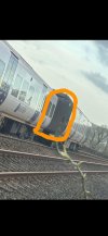
Does anyone know what that carriage inter-connecting bendy thing is made of?
 

Attachments

  • IMG-20240322-WA0002.jpg
    IMG-20240322-WA0002.jpg
    341.7 KB · Views: 104

Puffing Devil

Established Member
Joined
11 Apr 2013
Messages
2,769
National rail now saying line closed until Monday 8th April

Whilst specialist teams deal with this incident all lines will be closed between Barrow-in-Furness and Lancaster.

As a result, trains are unable to run between Barrow-in-Furness and Lancaster.

Disruption is expected until at least the end of the day on Monday 8 April.
 
Last edited by a moderator:

costafurness

New Member
Joined
25 Mar 2024
Messages
1
Location
Ulverston
Is there any update on the bus timetable? I’m going to Ulverston on Tuesday and would love some idea of roughly when the buses will leave Lancaster and when it should get in. Vice versa for Wednesday's return.
Personally I would look at going to Oxenholme or Kendal by train and catching the x6 service bus from there, on the hour £2 and as a bonus, a good view of the incident site.
 

Scooby

Member
Joined
20 Jul 2011
Messages
129
Here are a couple of pictures credited to Network Rail, from the Westmorland Gazette. The pictures aren't time/dated, but are possibly Sun 24th March (because of the sunshine !), or Mon 25th March

17896702.jpg
17896722.jpg


From the Westmorland Gazette article
"
From tomorrow morning (Monday 25 March) train services will run between Carlisle and Barrow on the Cumbrian coast line. Bus replacement services will be in operation between Barrow and Lancaster while the recovery of the train and repair work takes place at Grange.


Craig Harrop, regional director for Northern, said: “While services are unable to run between Barrow-in-Furness and Lancaster, we are working with partners to offer what rail replacement alternatives we can. This includes buses between Lancaster and Barrow calling at Lancaster, Carnforth, Silverdale, Arnside Grange-over-Sands, Kents Bank, Cark, Ulverston, Dalton, Roose and Barrow -In-Furness.

“Disruption is expected to last some time, so customers should make alternative arrangements wherever possible. We're sorry for the inconvenience and delay."

Which reads that Silverdale and Arnside will be getting a bustitution service, whic is very welcome
 
Last edited:

randyrippley

Established Member
Joined
21 Feb 2016
Messages
5,144
Funnily, marshland is normally considered quite an effective way of preventing flooding. It can hold a lot more water than (for example) a golf course or farmland and so prevent water from flooding areas you care more about. But yeah if your railway is in the marshland itself, not so good.
Problem is as I said upthread, the EA are deliberately holding the water table high, and not maintaining the drains so any additional water (i.e. in winter) causes excess flooding
 

Toby Atkinson

Member
Joined
1 Apr 2018
Messages
37
The line will surely be shut longer than 2 weeks? Why don’t they run shuttle trains to Grange from barrow and then from Arnside to Lancaster. With a shuttle bus between
 

stuving

Member
Joined
26 Jan 2017
Messages
266
I expected there to be an internal drainage board for an area like this, but could find no trace of one. There was a consultation run by the Environment Agency in 2015 on their proposal for an IDN for South Cumbria, which would include the Winster catchment and much more. In it I found this explanation of the background:
The Lyth Valley has the most intensively managed drainage system in the proposed
IDB area, consisting of a complex pumped drainage and flood defence system that
consists of embanked carrier watercourses referred to as the “high level system” and
a network of drainage channels referred to as “the low level system”. This system
reduces flooding of pasture in late autumn, winter and early spring, so it is dry
enough to support grazing. If pumping were to cease in this valley, there would be a
significant change in soil wetness and subsequently agricultural productivity.

Areas of the Winster, Bela, Lyth Valley, Duddon, Newland Moss and Windermoor
catchments were, until the late 1970’s, within Internal Drainage Districts. In 1975 the
River Kent Estuary IDB, River Winster IDB and the Beetham and Arnside IDB were
amalgamated to form a new River Kent Estuary Internal Drainage district.

These IDBs were progressively abolished throughout the late 1970s, ending in 1979
with the River Kent Estuary IDB drainage district. Maintenance of all assets and
‘scheduled watercourses’ previously maintained by the IDBs was taken over by the
North West Water Authority (later the National Rivers Authority and then the
Environment Agency).
The EA have a fixed budget, and a list of priorities for flood protection - houses, infrastructure, yes - but not agriculture, seen as a commercial activity able to pay for its own protection. So in the Lyth drainage area, they proposed withdrawing from paying for maintenance of pumps etc, and wanted to hand that over to the farmers (mainly). Obviously they felt a bit queasy about dumping a such a big bill on them, and tried to spread the costs over a much larger area. That (predictably) got a lot of objections from all those neighbouring areas, who didn't want to pay anything for no benefit to themselves.

Grange Town Council, for example, responded with:
• The Town Council considers that the drainage currently carried out by the Environment
Agency is solely for the benefit of agriculture.
• Allowing the land to revert to wetland would benefit wildlife and could offer opportunities
for diversification into tourism‐related activity
• Grange does not benefit from the Lyth Valley pumps, and Grange residents should not be
expected to pay for drainage which would benefit only a few businesses and would not
benefit the town or its residents in any way.
• The proposals have not been widely publicised and many residents remain unaware of the
proposal, which if implemented would directly impact their Council Tax charge.
So there is no drainage board to do anything; the EA are doing some maintenance work but are not likely to upgrade anything.
 
Status
Not open for further replies.

Top