• Our booking engine at tickets.railforums.co.uk (powered by TrainSplit) helps support the running of the forum with every ticket purchase! Find out more and ask any questions/give us feedback in this thread!

Derailment near Grange Over Sands

Status
Not open for further replies.

tpfx89

Member
Joined
1 Dec 2019
Messages
169
Location
Teesside
The bit that looks odd is that the front three coaches are all derailed, but the rear three seem to be absolutely fine!
I also thought this, then wondered whether the initial collapse/impact/derailment (mechanics still very much unclear) took enough momentum out that they were able to run over the suspended section without actually leaving the rails.

From some of the pictures floating around local Facebook groups, it looks like it’s struck the wall and knocked some of the top stones off and down the bank towards the sea. Not sure from looking if it’s held it in place or not.
Potentially just strong and sturdy enough to prevent the derailed vehicles from deviating too far to the left. Looking at the displacement of stones from what must have been the initial impact, there's a possibility that it may have continued off in that direction if it wasn't in place which would have been more concerning. Also worth noting that this took place right at the very end of a straight section, with the line curving off to the right shortly in front of where the train ended up.
 
Sponsor Post - registered members do not see these adverts; click here to register, or click here to log in
R

RailUK Forums

philthetube

Established Member
Joined
5 Jan 2016
Messages
3,762
The salt marsh is mostly covered in grass and does look rather like a meadow at times. Grange seafront is particularly unusual - a promenade with what looks like a field rather than sea next to it.
If it is where I think it is the sea does come up to the wall occasionally, the sheep have to be taken off the grass.
 

stuving

Member
Joined
26 Jan 2017
Messages
266
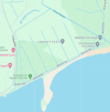
Here's a Google Maps link to a decent view of Grange "sea"front - looks similar to the photos above in terms of the "meadow".

The Google Map linked to that view gives a good idea of what the Ulverstone and Lancaster Railway did to Winster Bay, and its subsequent hydrology:
1711129684648.png
You can see the new cut for the Winster, and the old course via that long "fish pond" and then down beside Lindale Road. The three leftmost channels might all be called the old Winster, with the third one (nearest Holme Island) being marked on the last map (1845/48), with the railway added as a later revision.

Channels have been cut to drain the land for agriculture (or golf) into a stream behind Meathop Road and the railway, which runs past the old courses of the Winster to its culvert further west.
 

Amlag

Member
Joined
8 Jul 2018
Messages
228
From some of the pictures floating around local Facebook groups, it looks like it’s struck the wall and knocked some of the top stones off and down the bank towards the sea. Not sure from looking if it’s held it in place or not.


The bit that looks odd is that the front three coaches are all derailed, but the rear three seem to be absolutely fine!

Presume this train was not going very fast and was slowing down for its next stop at Grange -O-S which lessened the result of the derailment, helping to keep the vehicles upright and almost in line.
 

Mcr Warrior

Veteran Member
Joined
8 Jan 2009
Messages
11,861
So, to recap, what's the most likely cause?.A collapsed culvert/land drain running at right angles underneath the railway line?
 

stuving

Member
Joined
26 Jan 2017
Messages
266
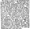
This description of what the embankment was built from comes from The Engineer, via
Soulby's Ulverston Advertiser and General Intelligencer of 6 November 1856 (and the BNA):
1711132884709.png

This goes on to describe how, as the embankment was built out across Winster Bay from both ends, the spring tides racing through the gap would remove the work faster than it could be built, So they developed a technique of protecting the toe of the bank with stones during the springs and waiting until doing their building work during the neaps.

Note that the "sea" off this embankment is really the estuary of the River Kent, and the "sea" that runs into is Morecambe Bay, and at low tide none of this is exactly "sea" in the normal sense.
 

King Lazy

Member
Joined
24 Apr 2019
Messages
59
Presume this train was not going very fast and was slowing down for its next stop at Grange -O-S which lessened the result of the derailment, helping to keep the vehicles upright and almost in line.
The derailment point is pretty much at a decent braking point for Grange Over Sands so it is possible that the train was still near linespeed. Of course there are plenty of other possibilities but a speed of 50+ here would not be unusual.
 

edwin_m

Veteran Member
Joined
21 Apr 2013
Messages
24,929
Location
Nottingham
Presume this train was not going very fast and was slowing down for its next stop at Grange -O-S which lessened the result of the derailment, helping to keep the vehicles upright and almost in line.
The derailment of the front bogie suggests the collapse was sometime before the train arrived, not underneath it, so the driver may have seen the damage ahead and hit the brakes before reaching it. But also, as the front of the train derailed it would decelerate much more rapidly than even an emergency brake. #14 shows that it stopped not far beyond the collapse, so the rear of the train would have been going much more slowly than the front when it passed over.
 

30907

Veteran Member
Joined
30 Sep 2012
Messages
18,065
Location
Airedale
I really don't think a train of, say, Mk1s would have been reduced to "matchsticks" full of "mashed up" people by this - there was little lateral deflection, on a straight stretch of track, and I imagine any fairly modern carriages would have stayed upright.
Indeed, phrases similar to "a testament to modern standards" were used in reports of accidents involving steel-framed or all-steel buckeyed stock, and later of Mk3s, in each compared to their predecessors. But that's slightly OT.
 

M60lad

Member
Joined
31 May 2011
Messages
860
Out of interest once the time comes how will these units be moved, could they be moved under their own power and who would move them? Also where will they be moved to be repaired should any serious damage been caused to them?
 

Ken X

Member
Joined
29 Nov 2021
Messages
153
Location
Horsham
Knowing nothing about this particular location, if there was a culverted waterway which passed under the rail bed at this point, the original culvert may well have been lined with wood as was common at the time. The wood will have degraded and may have allowed the culverted water flow to erode the surrounding embankment causing a void. Said void remaining undetected until the roof of the void failed under pressure from the railway line.

It has happened more than once on the canal network where it causes a sudden breach as the canal bed falls into the failed culvert, suddenly increasing the flow massively.

The early warning of increasing culvert flow is obviously not present on the railway so sudden failure of a culvert is more possible I guess.
 

Meole

Member
Joined
28 Oct 2018
Messages
465
There was extensive remedial work by contractors on the sea wall a couple of years ago, concrete spraying, ground nails, culvert rebuilt with new guard rail.
At this location the coastal path is seaward crossing inland soon after because the viaduct is not available to walkers.
 

M60lad

Member
Joined
31 May 2011
Messages
860
According to Northern and National Rail disruption is due to last now until at least end of day on 8th April.
 

Agent_Squash

Established Member
Joined
22 Jul 2016
Messages
1,233
Can you tell us how the track maintenance regimes have changed recently on that line then?
Please read my other comment…

I think it’s very reasonable to make the point about maintenance on this one.

I’m not suggesting that it is the responsibility of maintenance; but rather they should be given the support to look out for these things.

It may just be unfortunate; but we need to always be looking at ways to improve, and having the ability to fund more proactive monitoring is part of that.

NR is actively following a reactive maintenance strategy. I would hope that this risk was identified months ago, but it doesn’t look like it was.
 

stuving

Member
Joined
26 Jan 2017
Messages
266
This is an article from January 2023 for the adjacent area. https://www.thewestmorlandgazette.c...thop-road-leaves-grange-golf-club-underwater/

If my memory serves me correctly, there are follow up articles relating to the same culvert, with various organisations not taking responsibilty / ownership of the problem.
This is a more recent (and not paywalled) article, from The (NWE) Mail, in part saying:
He said: “Ten years ago, there were 800 members at the club, but now there is just over 300. Financially it becomes not a viable proposition.

“If you can’t provide reliability for people, especially if they can go only play on a weekend, then I don’t think the club will continue. It needs resolving but there is no magic wand and not an overnight solution.”

Grange Golf Club has a permit to excavate silt from the outfall of Seldom Seen Culvert, under J T Atkinson Builders’ Merchant, out into Morecambe Bay for a distance of 30 metres, once a year until 2027.

The club has applied to the Environment Agency (EA) to vary this permit further to allow it to form a channel from the outfall of Seldom Seen Culvert to the River Kent in the bay.

Mr Micklethwaite explained: “The biggest problem is there is too much sand and silt in Morecambe Bay. The bay is a site of special scientific interest so it’s not easy to get access onto the foreshore to keep them clear.
(I do like that quote about "the biggest problem is there is too much sand and silt in Morecambe Bay" - very Lewis Carroll!)

J T Atkinson's yard is next to the footbridge at Blawith Point, so that's where this Seldom Seen Culvert is. The text says there is a second outlet, but not where it is. This bit:
The EA say when the River Winster rises in periods of very wet weather, it causes the non-return flap to close, which results in water from Meathop Road Drain not being able to flow into the River Winster.
sounds to me as if this flap valve has to be at the other end, where the Winster is. A channel leading there is shown on the excerpt from Google Maps (above), though the old OS maps are much less clear on this.

There is also a significant water channel in the sands to the east of the Holme Island causeway, so that's another possible site for a culvert. Note that there is no visible channel through the sands at Blawith Point, suggesting this outfall really is blocked.

The repair work is mentioned too:
The EA said it carried out extensive repairs to part of the River Winster flood embankment in 2022. During this time they also installed a new headwall structure and flap valve, as well as carrying out channel maintenance on Meathop Road Drain.
Network rail isn't mentioned as having any responsibility, even for the core of the embankment itself, except in a quote form Tim Farron MP suggesting they should work together with the relevant bits of government. I wonder if some quirk of legal history really has let them off that hook?
 
Last edited:

Nicholas Lewis

Established Member
Joined
9 Aug 2019
Messages
6,132
Location
Surrey
There's a video showing the affected damage right up close, here
The area of ballast loss is far bigger than you would expect from a culvert collapse and its only on one road although it could have been many months of being eroded from underneath and the passage of this train led to the failure this morning. Also if it was an area where track top was constantly going off you would expect more evidence of fresh ballast which there isn't so in all likelihood the local track maintenance team wouldn't be aware. Culverts are subject to an inspection regime the frequency im not aware but at least with RAIB quickly declaring an interest it will be interesting to see what they report here in due course.
 

Scooby

Member
Joined
20 Jul 2011
Messages
129
This is a more recent (and not paywalled) article, from The (NWE) Mail, in part saying:

(I do like that quote about "the biggest problem is there is too much sand and silt in Morecambe Bay" - very Lewis Carroll!)

J T Atkinson's yard is next to the footbridge at Blawith Point, so that's where this Seldom Seen Culvert is. The text says there is a second outlet, but not where it is. This bit:

sounds to me as if this flap valve has to be at the other end, where the Winster is. A channel leading there is shown on the excerpt from Google Maps (above), though the old OS maps are much less clear on this.

There is also a significant water channel in the sands to the east of the Holme Island causeway, so that's another possible site for a culvert. Note that there is no visible channel through the sands at Blawith Point, suggesting this outfall really is blocked.

The repair work is mentioned too:

Network rail isn't mentioned as having any responsibility, even for the core of the embankment itself, except in a quote form Tim Farron MP suggesting they should work together with the relevant bits of government. I wonder if some quirk of legal history really has let them off that hook"
Thank you for the additional post stuving. I didn't realise that my original link was paywalled, as I coud read it OK !
Something in that locale isn't right, as swathes of Grange Golf Course, which lie on the other side of the embankment have been underwater for months now (or have been every time I've driven past, for, ahem, many months !)

This piccie, from a Dec 23 Mail article gives you an idea of the sogginess in that area.

17572531
 
Last edited:

stuving

Member
Joined
26 Jan 2017
Messages
266
Network Rail do in fact manage the drainage of the area, so that article was misleading. In particular, they own and operate the tidal gates (sluice) at Arnside, the mouth of the Winster. Like all tidal gates, they can only work if "tidal locking" blocks the outflow for a short period at high tide. If the closure is too long, the river flow itself causes flooding.

This 2018 technical paper summarises the results of work commissioned by NR from AECOM, and is called "Managing legacy infrastructure into the future: the River Winster and Meathop Drain flood risk". I can't copy quotes from it, but it does talk about reopening the Seldom Seen culvert (i.e. it is blocked), and says that NR installed a small pump taking water "over the embankment", discharging "close to the Seldom Seen culvert". I think that must be what those pipes near the site of the collapse are for; they would be buried under the track.

There is, of course, a lot more to it, explained in the paper. Whatever you do the rivers, tides, and all that sand and silt will do their own thing in response. And as the man said, there is too much sand and silt in Morecambe Bay.
 
Last edited:

Open top 80

Member
Joined
17 Aug 2023
Messages
47
Location
Bournemouth
It a good job this didn't happen in around mid morning on a Bank holiday Saturday as the train would have been packed with Passenger's going to Cartmell races and getting off at Cark
 

norbitonflyer

Established Member
Joined
24 Mar 2020
Messages
2,400
Location
SW London
From a historial perspective, a sink hole seems favourite ... way back in time (1892) the Furness Railway lost an entire locomotive down a sink hole which opened up in front of the crew ... it subsequently deepened and the loco disappeared from view ... don't know if it was ever recovered ... location cited as "Lindal" which seems to be about right and the apparent cause was collapsed mine workings ...
It wasn't. No 115 is technically the only Furness Railway "D1" still in existence (minus its tender, which was recovered at the time), the others having all been cut up.
 

pokemonsuper9

Established Member
Joined
20 Dec 2022
Messages
1,716
Location
Greater Manchester
It a good job this didn't happen in around mid morning on a Bank holiday Saturday as the train would have been packed with Passenger's going to Cartmell races and getting off at Cark
Would people be on the first train of the day for that?
I can't imagine there'd be hoards of people in Preston at 5am.
 

janb

Member
Joined
16 Jul 2008
Messages
678
Do many people go to Cark for Cartmel races? It's quite a long walk. I'd have thought most would drive.

Yes, trains very busy. Shuttle bus operates from Cark station to the racecourse and back.

Perhaps more relevantly, Morecambe vs Barrow scheduled for 1st April will seemingly be impacted now.
 
Status
Not open for further replies.

Top