• Our booking engine at tickets.railforums.co.uk (powered by TrainSplit) helps support the running of the forum with every ticket purchase! Find out more and ask any questions/give us feedback in this thread!

Derailment near Grange Over Sands

Status
Not open for further replies.

swt_passenger

Veteran Member
Joined
7 Apr 2010
Messages
31,442
Please read my other comment…


NR is actively following a reactive maintenance strategy. I would hope that this risk was identified months ago, but it doesn’t look like it was.
Identifying a risk months ago wouldn't be reactive. Reactive is dealing with something after it had already happened. Did you mean to write proactive?
 
Sponsor Post - registered members do not see these adverts; click here to register, or click here to log in
R

RailUK Forums

Agent_Squash

Established Member
Joined
22 Jul 2016
Messages
1,233
Identifying a risk months ago wouldn't be reactive. Reactive is dealing with something after it had already happened. Did you mean to write proactive?

No, I mean’t reactive. If the strategy was proactive it would’ve been mitigated ASAP.

Obviously this thread is bringing to light the unique tidal conditions that Morecambe Bay brings though, and there is a a lot of complexity in that.
 

NorthWestRover

Established Member
Joined
24 Aug 2018
Messages
1,466
The daytime trains are all pretty busy at the weekend. Mix of visitors to Silverdale, Arnside, Grange, Ulverston; locals going from one village to another; younger People going to Lancaster or Preston for a night out.
 

Howardh

Established Member
Joined
17 May 2011
Messages
8,185
Thank you for the additional post stuving. I didn't realise that my original link was paywalled, as I coud read it OK !
Something in that locale isn't right, as swathes of Grange Golf Course, which lie on the other side of the embankment have been underwater for months now (or have been every time I've driven past, for, ahem, many months !)

This piccie, from a Dec 23 Mail article gives you an idea of the sogginess in that area.

17572531
Looks like the sea defence is perfect, but it's holding in all the rainwater from inland!
 

BrianW

Established Member
Joined
22 Mar 2017
Messages
1,459
Thank you for the additional post stuving. I didn't realise that my original link was paywalled, as I coud read it OK !
Something in that locale isn't right, as swathes of Grange Golf Course, which lie on the other side of the embankment have been underwater for months now (or have been every time I've driven past, for, ahem, many months !)

This piccie, from a Dec 23 Mail article gives you an idea of the sogginess in that area.

17572531
Thank you for this, Scooby. I find the piccie most informative. Looks like a substantial length of line with water on both sides of the embankment- a lot of weight of water 'going nowhere', not drained by the Seldom Seen Culvert! One for the hydrological engineers?
 

Bletchleyite

Veteran Member
Joined
20 Oct 2014
Messages
97,896
Location
"Marston Vale mafia"
Thank you for this, Scooby. I find the piccie most informative. Looks like a substantial length of line with water on both sides of the embankment- a lot of weight of water 'going nowhere', not drained by the Seldom Seen Culvert! One for the hydrological engineers?

Well, a couple of culverts and a massive pile of rocks appears to have solved it for the Conwy Valley...
 

randyrippley

Established Member
Joined
21 Feb 2016
Messages
5,140
Network Rail do in fact manage the drainage of the area, so that article was misleading. In particular, they own and operate the tidal gates (sluice) at Arnside, the mouth of the Winster...........
The Winster goes nowhere near Arnside, which is on the other side of the Kent estuary.

Thank you for this, Scooby. I find the piccie most informative. Looks like a substantial length of line with water on both sides of the embankment- a lot of weight of water 'going nowhere', not drained by the Seldom Seen Culvert! One for the hydrological engineers?
Difficult to see how it can be solved without dropping the deliberately raised water table in the Foulshaw and Meathop Mosses, which are both nature reserves. There has been a deliberate attempt to return them to marshland over the last 15 or so years. If you add that to continued complaints over years about the inability of the authorities to make the Winster valley drainage work and you've got a lot of water with nowhere to go.

Just found this 2018 document (8 page pdf) which overviews the drainage in the area, the flood risk, and the history.
It explains how the Winster and associated waterways are protected and linked, and how they relate to the railway embankment

(Unfortunately it won't let me copy the text so I can't post a preview)
 
Last edited:

stuving

Member
Joined
26 Jan 2017
Messages
266
The Winster goes nowhere near Arnside, which is on the other side of the Kent estuary.


Difficult to see how it can be solved without dropping the deliberately raised water table in the Foulshaw and Meathop Mosses, which are both nature reserves. There has been a deliberate attempt to return them to marshland over the last 15 or so years. If you add that to continued complaints over years about the inability of the authorities to make the Winster valley drainage work and you've got a lot of water with nowhere to go.

Just found this 2018 document (8 page pdf) which overviews the drainage in the area, the flood risk, and the history.
It explains how the Winster and associated waterways are protected and linked, and how they relate to the railway embankment

(Unfortunately it won't let me copy the text so I can't post a preview)
Yes, I don't where I got Arnside from for the sluice - it doesn't really need a name other than Winster anyway.

That report is of course the AECOM one I cited last night.
 

snowball

Established Member
Joined
4 Mar 2013
Messages
7,743
Location
Leeds
For some reason it lets me copy quotes, though they come out a bit messy. It would be a lot to copy but here's the abstract.

3rd International Conference on Protection against Overtopping, 6-8 June 2018, UK

Managing Legacy Infrastructure into the Future: The River
Winster and Meathop Drain Flood Risk.
A.J Forster1 and D. Glasson AECOM, Alençon Link, Basingstoke, RG21 7PP

Abstract
The completion of the Ulverston and Lancaster Railway in the 1850s included the Arnside viaduct and an em-
bankment on the northern side of Morecambe Bay enabling the railway to reach Grange-over-Sands. The em-
bankment was built across the mouth of the River Winster and resulted in a change to the tidal inundation pattern of
the mudflats and saltmarsh area protected by the embankment. The protected area was reclaimed and is now par-
tially developed to include valuable agricultural land, residential properties and a golf club, as well as vital trans-
portation and utility infrastructure.
The sand within Morecambe Bay is extremely mobile causing the migration of drainage channels and has resulted
in the construction of training walls for the two main discharges, the River Kent and River Winster, to enable effi-
cient drainage into the bay. The River Winster is further controlled, as it flows under the embankment, by tidal
gates that have been modified over the past 100 years. Since its construction the embankment has performed effec-
tively as a coastal defence and still currently provides protection against significant coastal events. In recent times
however the flood risk on the landward side of the embankment has increased from fluvial events and is anticipated
to increase further due to climate change and other external factors. This paper will examine the possible causes of
the increase and concludes that it is the natural processes of the estuary that have resulted in the increased flood
risk. The implication for the future management of the embankment and river channels is also discussed.
 

Aviator88

Member
Joined
22 Oct 2012
Messages
314
I'm brand new to the railway.

How are these things normally monitored/prevented, from an engineering/geological perspective? Soundings and soil samples seem like a good start, but what else?

Are there defined maximum intervals whereby each and every section of track/ballast/subgrade is inspected? Or is it on a purely risk assessed basis?

I always assumed that the integrity of the railway infrastructure was a watertight (pun unintended) and very well oiled machine. The mind can't help but wonder what the result would have been had this occurred on a 125 mph line, and under marginally worse circumstances.
 

Undiscovered

Member
Joined
28 Jan 2013
Messages
414
Engines stopping, intercar cables cut, emergency stop button? Just thoughts, I don't know.
Cheers for that.

So, any reason why the headlights go out at point of derailment? Would the carriage lights also have gone totally, or would emergency systems activate?
 

156421

On Moderation
Joined
23 Aug 2022
Messages
298
Location
Weſtmorland 'n' Furneß
Unlike the Workington to Carlisle closure (which thankfully soon is drawing to a close), this closure isn't showing RRBs on real time trains, although according to local rumors there are indeed RRBs running.
 

PyrahnaRanger

Member
Joined
16 Aug 2022
Messages
83
Location
Lancashire
@Scooby thanks for the aerial photo - I went this way to London last week, and large swathes of the country appear to be pretty much inundated with water at the moment - high tide as we went passed that way was highest I’ve ever seen it.

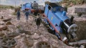
On a more general note, I’m sure I’ve been told that the Furness engine falling down the sinkhole was the inspiration for one of the Thomas The Tank Engine tales - could we be due another book? ;)
 

stuving

Member
Joined
26 Jan 2017
Messages
266
I would assume due to the servere impact and damage to the train that it lost all power etc
There wasn't an actual impact, was there? From the big clouds of dust thrown up, I'd guess that flying ballast was the main cause of damage, wrecking a lot of the systems in boxes under the floor.
 

Winthorpe

Member
Joined
18 May 2019
Messages
186
Location
Manchester
On a more general note, I’m sure I’ve been told that the Furness engine falling down the sinkhole was the inspiration for one of the Thomas The Tank Engine tales - could we be due another book? ;)

I remember that story well (even though it was a long time since I read those books) :lol:

download.jpg
 

randyrippley

Established Member
Joined
21 Feb 2016
Messages
5,140

skyhigh

Established Member
Joined
14 Sep 2014
Messages
5,330
2) the up signal goes to danger as the train is still passing it in the other direction- someone's reactions were pretty quick
Or it cut the cable as it went... It was posted upthread that the controlling signalbox was switched out.
 

thenorthern

Established Member
Joined
27 May 2013
Messages
4,119
I would imagine it's a top priority for Network Rail to get the line repaired given it's the main route for the nuclear trains.

Given the low loading gauges for the Cumbria Coast line are nuclear trains allowed to go via Whitehaven to get to Carlisle?
 

MeathopMermaid

New Member
Joined
23 Mar 2024
Messages
1
Location
Witherslack, Meathop & Ulpha
Some background info ... Meathop Road runs parallel to the railway for a mile, including in the area where the derailment happened. ln the last few years the road has been chronically prone to flooding, causing many issues to road users, vehicles, and land wners alike. A local farmer has been documenting this from his tractor cab. This video - filmed on 12 December 2023 shows the sitaution. It may also demonstrate the issue that emergency services had in getting vehicles to the nearest rod access point (Holme Island).
 
Status
Not open for further replies.

Top