• Our booking engine at tickets.railforums.co.uk (powered by TrainSplit) helps support the running of the forum with every ticket purchase! Find out more and ask any questions/give us feedback in this thread!

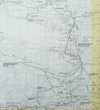
Lincolnshire stations - a map

Status
Not open for further replies.

YorksLad12

Established Member
Joined
5 Feb 2020
Messages
1,907
Location
Leeds
Whoops. I did it again...

I went to a wedding in June, in Woodhall Spa. It cost me £30 by taxi to get there from Metheringham, and £60 on the Sunday as I had to return from Lincoln. But I did spot there was a Station Road, and a walking route up to Horncastle, and since it was a really lovely wedding I thought I'd map out Lincolnshire's stations in the same way I did Yorkshire's.

Version 1 is attached for your perusal and usual amendments, comments and criticisms, especially from the locals (looking at you, @High Dyke). I've still got the station notes, etc to write up, but I might have a complete Version 1 in time for Lincolshire Day, 1 October. Depending on your comments, of course ;)

Oh: if anyone's wondering if there's a combined Yorkshire & Lincolnshire map... there isn't. Not yet. They can be made to fit together though 8-)
 

Attachments

  • LincolnshireStations1.pdf
    111.8 KB · Views: 229
Last edited:
Sponsor Post - registered members do not see these adverts; click here to register, or click here to log in
R

RailUK Forums

High Dyke

Established Member
Joined
1 Jan 2013
Messages
4,287
Location
Yellabelly Country
Well done. Good presentation. A couple of points (literally) ;)
  • No link at Stamford to show the connection from the Essendine line into the (MR) Stamford station. Services from Essendine transferred there, albeit briefly, when Stamford East closed.
  • A key to the map would be useful.
 

YorksLad12

Established Member
Joined
5 Feb 2020
Messages
1,907
Location
Leeds
Well done. Good presentation. A couple of points (literally) ;)
  • No link at Stamford to show the connection from the Essendine line into the (MR) Stamford station. Services from Essendine transferred there, albeit briefly, when Stamford East closed.
  • A key to the map would be useful.
Stamford seemed quite easy at first glance. It was only when I ran out of space that I realised that it wasn't... Oddly, Rail Map online doesn't include a link between the two routes, which is be why I forgot to include it (ahem). Also oddly, the NLS side-by-side viewer for the OS Six-Inch 1888-1913 map shows a link already in place (but now whose it was). Have done it in BR blue for now, as a post-Grouping piece of track (which might be different to the one on the map anyway).

There is a key, of sorts, bottom-left. The 'final' version is done in InDesign, and has a panel with more context about the scope of the map, such as...

Don’t forget the branch line to the docks at Boston
There wasn't a timetabled, passenger service to the docks (or even a station, that I can see). That's my limiting factor, otherwise I could be here forever adding goods yards and depots. And don't think I wasn't tempted o_O

Really like this - very useful!
Thank you. Thinking of doing a standalone Cornwall map next, or combining Yorkshire & Lincolnshire and in-filling the gaps caused by Nottinghamshire. Or have a long lie down in a darkened room, it could go either way really.
 

Justin Smith

Member
Joined
14 Nov 2009
Messages
1,073
Location
Sheffield
Whoops. I did it again...

I went to a wedding in June, in Woodhall Spa. It cost me £30 by taxi to get there from Metheringham, and £60 on the Sunday as I had to return from Lincoln. But I did spot there was a Station Road, and a walking route up to Horncastle, and since it was a really lovely wedding I thought I'd map out Lincolnshire's stations in the same way I did Yorkshire's.

Version 1 is attached for your perusal and usual amendments, comments and criticisms, especially from the locals (looking at you, @High Dyke). I've still got the station notes, etc to write up, but I might have a complete Version 1 in time for Lincolshire Day, 1 October. Depending on your comments, of course ;)

Oh: if anyone's wondering if there's a combined Yorkshire & Lincolnshire map... there isn't. Not yet. They can be made to fit together though 8-)
Very interesting YL, well done, how long did it take you ? ! ?
Have you got a copy of Cobbs historical rail atlas ?
Here is sample page from my annotated Cobbs (area west of Edinburgh) :

Cobbs rail atlas (west of Edinburgh) 1000W L5 384kB.jpg
 

YorksLad12

Established Member
Joined
5 Feb 2020
Messages
1,907
Location
Leeds
Very interesting YL, well done, how long did it take you ? ! ?
Have you got a copy of Cobbs historical rail atlas ?
Here is sample page from my annotated Cobbs (area west of Edinburgh) :
Thank you Justin - This has taken me fours months, on and off (mostly off) so far. The Yorkshire map is still getting corrections, so I'd never say it was finished...

I don't have Cobbs, but I do use (and have made a donation to, only fair) https://www.railmaponline.com/UKIEMap.php to check junctions, as well as the Railway Clearing House maps and anything else I can find on the interweb. Haven't looked at Adlestrop yet for the Lincolnshire map, which is odd.
 

32475

Member
Joined
2 Nov 2019
Messages
748
Location
Sandwich
Thank you Justin - This has taken me fours months, on and off (mostly off) so far. The Yorkshire map is still getting corrections, so I'd never say it was finished...

I don't have Cobbs, but I do use (and have made a donation to, only fair) https://www.railmaponline.com/UKIEMap.php to check junctions, as well as the Railway Clearing House maps and anything else I can find on the interweb. Haven't looked at Adlestrop yet for the Lincolnshire map, which is odd.
Thanks for highlighting the railmaponline website YorksLad12. It’s extremely useful and great for scrutinising obscure nooks and crannies of the country. I’ve now added it to my favourites bar!
 

Justin Smith

Member
Joined
14 Nov 2009
Messages
1,073
Location
Sheffield
Thank you Justin - This has taken me fours months, on and off (mostly off) so far. The Yorkshire map is still getting corrections, so I'd never say it was finished...

I don't have Cobbs, but I do use (and have made a donation to, only fair) https://www.railmaponline.com/UKIEMap.php to check junctions, as well as the Railway Clearing House maps and anything else I can find on the interweb. Haven't looked at Adlestrop yet for the Lincolnshire map, which is odd.
That resource is really interesting.
 

YorksLad12

Established Member
Joined
5 Feb 2020
Messages
1,907
Location
Leeds
Happy Lincolnshire Day! "Finished" version, with notes, attached. Many thanks for the comments and suggestions, included where possible. I say "finished", there's probably more than a few errors, and I'm not as happy with it as with the Yorkshire one. Plus, I'm thinking that I'll only maintain the Yorkshire one as a separate map in the future, and use it to create one master map for when I add in Nottinghamshire, Derbyshire, etc., so it might never get beyond version 1.x.

Really tempted to do Rutland though... ;)
 

Attachments

  • Lincolnshire Stations 1.pdf
    325.8 KB · Views: 47

Chrius56000

Member
Joined
18 Aug 2010
Messages
53
North Thoresby actually closed anong with all the East Lincolnshire system, the official date of closure in all the references I've seen, for some strange reason, was 4 October 1970!

It was the only station remaining open between Grimsby & Louth at the time the system closed – I believe it got dark blue Eastern Region totems, but I'll have to check my Totem Bible for that!

Chris Williams
 
Status
Not open for further replies.

Top