• Our booking engine at tickets.railforums.co.uk (powered by TrainSplit) helps support the running of the forum with every ticket purchase! Find out more and ask any questions/give us feedback in this thread!

Longest line of sight (UK)

nw1

Established Member
Joined
9 Aug 2013
Messages
7,279
While they are in the Southern part of the Pennines, the Pennines are divided into a series of distinct geographical areas based either on the geology of the area and/or the natural boundaries provided by the major river valleys. The above-mentioned hills are considered to be in the 'Dark Peak' (i.e. consisting of millstone grit), while to the South is the 'White Peak' (consisting of magnesian limestone). The 'South Pennines' are generally considered to be the area South of Airedale/Ribblesdale and North of the Etherow and Don valleys.

Ah, ok - thanks. Yes, I was aware of the Dark Peak and White Peak for the areas further south.

I did once (in the year 2000, with my last-ever journey on a first-gen DMU being the transport there) do the southern part of the Pennine Way. I went as far as Horton, before turning westwards over Ingleborough and Whernside and eventually to the Lake District, and can see that the hills did divide into these areas. The "South Pennines" area definitely seemed lower and less wild, compared to both the Dark Peak to the south of it, and the Dales to the north - and an entire day's worth of walking, from Lothersdale (had to look it up, it's been a while) to Malham appeared to be completely over lowland country.
 
Sponsor Post - registered members do not see these adverts; click here to register, or click here to log in
R

RailUK Forums

RogerOut

Member
Joined
16 Nov 2019
Messages
127
Location
Sussex
I came across this incredible photo taken at night from above Conwy. (I saw it on Twitter and it’s credited to a photographer named Mel Hughes from a Facebook page called Footpaths of Snowdonia).

It took me a while to figure out the angle of the near locations in the foreground. It’s looking in an easterly direction, and captures the brightness of the docks at Seaforth.

What transmitter, mast would that be to the left of the photo?
 

nw1

Established Member
Joined
9 Aug 2013
Messages
7,279
Sorry , this one, transmitter far left in the picture, with red lights;


The picture apparently taken over Conwy, North Wales.

Ah ok, it's a slightly confusing picture as the River Conwy is not visible, and the two hills in the foreground look very close, when presumably they are over the other side of the Conwy towards Llandudno and Colwyn Bay.

The docks in the distance are presumably Liverpool, which would suggest the transmitter is Winter Hill, north of Bolton. I'd be surprised if the lights are ever that prominent to the naked eye, so I presume some kind of enhancement has taken place?

Also the bright orange sodium lights in the foreground must date the photo a little bit, to early-mid 2010s at the latest, as in recent years these have become almost extinct.
 

RogerOut

Member
Joined
16 Nov 2019
Messages
127
Location
Sussex
Ah ok, it's a slightly confusing picture as the River Conwy is not visible, and the two hills in the foreground look very close, when presumably they are over the other side of the Conwy towards Llandudno and Colwyn Bay.

The docks in the distance are presumably Liverpool, which would suggest the transmitter is Winter Hill, north of Bolton. I'd be surprised if the lights are ever that prominent to the naked eye, so I presume some kind of enhancement has taken place?

Also the bright orange sodium lights in the foreground must date the photo a little bit, to early-mid 2010s at the latest, as in recent years these have become almost extinct.

Oh interesting thanks. I’m not really familiar with the North West. Although if the picture was taken from North Wales, the camera is obviously facing east towards the North West of England. So Bolton is slightly north east of Liverpool, so that could be the Winter Hill transmitter as you said. The transmitter would be north of Liverpool as you look at it.

I know nothing about photography, or cameras, I’m assuming the person taking the picture has enhanced it too.
 

Altrincham

Member
Joined
22 Aug 2011
Messages
262
What transmitter, mast would that be to the left of the photo?

Ah ok, it's a slightly confusing picture as the River Conwy is not visible, and the two hills in the foreground look very close, when presumably they are over the other side of the Conwy towards Llandudno and Colwyn Bay.

The docks in the distance are presumably Liverpool, which would suggest the transmitter is Winter Hill, north of Bolton. I'd be surprised if the lights are ever that prominent to the naked eye, so I presume some kind of enhancement has taken place?

Also the bright orange sodium lights in the foreground must date the photo a little bit, to early-mid 2010s at the latest, as in recent years these have become almost extinct.

The transmitter is Winter Hill above Bolton. In the middle of the picture is Seaforth and Crosby (outside Liverpool) with the cranes and industrially-lit seafront.

Looking at my map, it looks like the photo is taken from the hills around the Sychnant Pass and is looking almost due east. The hill in the near-front to the left looks like it’s Bryn Pydew, and this means that Rhos-on-Sea is the other side of that hill.

In the near front (centre) of the picture is the railway footbridge on the eastern side of the River Conwy.

Took me a while to get my head around this picture as the River Conwy is not visible.

[***EDITED to add the following text on the subject of the Pennines***]

I am fascinated with the geography of the Pennines (and its geology). I am familiar with the southern parts around the High Peak/Dark Peak areas, and also the West Pennine Moors around Winter Hill.

I often wonder where the physical elements of the southern Pennines start.

I know the areas around north Staffordshire and south Derbyshire quite well, and I always like to catch sight of the very prominent appearance of uplands to the north of Uttoxeter from the Stoke-Derby A50 corridor. These are the Weaver Hills above Alton Towers.

Given how dramatic they rise when viewed from the relative flatness of south and east Derbyshire, I always think that the Weaver Hills physically mark the beginning or end of the Pennine chain. They certainly give some fabulous vantage points for some very good lines of sight that take in both East Midlands and West Midlands.

Heading south of the Weaver Hills, the next uplands encountered with significant height are the Cotswolds and the Malverns.
 
Last edited:

nw1

Established Member
Joined
9 Aug 2013
Messages
7,279
I am fascinated with the geography of the Pennines (and its geology). I am familiar with the southern parts around the High Peak/Dark Peak areas, and also the West Pennine Moors around Winter Hill.

I often wonder where the physical elements of the southern Pennines start.

I know the areas around north Staffordshire and south Derbyshire quite well, and I always like to catch sight of the very prominent appearance of uplands to the north of Uttoxeter from the Stoke-Derby A50 corridor. These are the Weaver Hills above Alton Towers.

Given how dramatic they rise when viewed from the relative flatness of south and east Derbyshire, I always think that the Weaver Hills physically mark the beginning or end of the Pennine chain. They certainly give some fabulous vantage points for some very good lines of sight that take in both East Midlands and West Midlands.

Heading south of the Weaver Hills, the next uplands encountered with significant height are the Cotswolds and the Malverns.

Interesting - I'm more familiar with the M6 / WCML corridor so for me, Mow Cop seems to mark the southernmost limit of the Pennines. It's here where the high, prominent hills end when viewed from the west - though moderately high ground continues southwestwards from there, passing to the north and west of Stoke and even into north Shropshire, before melting away into the lowlands around Shrewsbury.

Indeed, Mow Cop is the last summit above 300m on that side until you hit the Shropshire hills further south.
 

Altrincham

Member
Joined
22 Aug 2011
Messages
262
Interesting - I'm more familiar with the M6 / WCML corridor so for me, Mow Cop seems to mark the southernmost limit of the Pennines. It's here where the high, prominent hills end when viewed from the west - though moderately high ground continues southwestwards from there, passing to the north and west of Stoke and even into north Shropshire, before melting away into the lowlands around Shrewsbury.

Indeed, Mow Cop is the last summit above 300m on that side until you hit the Shropshire hills further south.

Yes, I would put Mow Cop as the first visible upland indication of the beginnings of the Pennine chain when viewed from the west/M6/WCML. The Weaver Hills can be seen from Mow Cop and is nudged to the south ever so slightly by being east-south-east of Mow Cop.

For the most dramatic lines of sight at these southern extremities, Mow Cop definitely wins. To be able to see Manchester, Liverpool, Snowdon, Powys, Shropshire, and the West Midlands from one spot is incredible.

For the very southern physical extremity of the Pennines, I’d say the Weaver Hills above the village of Wootton.

Hopefully this link should show how the escarpment drops quite steeply to the south.


Shaw S Hunter

Established Member
Joined
21 Apr 2016
Messages
2,969
Location
Sunny South Lancs
The docks in the distance are presumably Liverpool, which would suggest the transmitter is Winter Hill, north of Bolton. I'd be surprised if the lights are ever that prominent to the naked eye, so I presume some kind of enhancement has taken place?
I know nothing about photography, or cameras, I’m assuming the person taking the picture has enhanced it too.
I doubt that any enhancement has taken place, just a well executed long exposure. In recent years I've noticed that the navigation warning lights fitted to tall transmitters have been noticeably upgraded making them highly visible over considerable distances when weather conditions allow. That picture was taken from roughly 60 miles away, you can imagine how bright it seems from my home barely 8 miles from it.
 

Altrincham

Member
Joined
22 Aug 2011
Messages
262
I doubt that any enhancement has taken place, just a well executed long exposure. In recent years I've noticed that the navigation warning lights fitted to tall transmitters have been noticeably upgraded making them highly visible over considerable distances when weather conditions allow. That picture was taken from roughly 60 miles away, you can imagine how bright it seems from my home barely 8 miles from it.
Winter Hill has been especially bright at night in recent years. I’ve caught sight of Winter Hill at night from the Staffordshire border around junction 16 of the M6.

From Altrincham, there’s certain times when it’s also possible to catch sight of the lights of Holme Moss transmitter in West Yorkshire.

Transmitter lights do seem a lot brighter these days.

From Snae Fell you can see mountains in Ireland, Scotland, Wales and England

There’s an incredible range of views from Snae Fell. Quite incredible from one spot it could be possible to see Mull of Kintyre, Northumberland (Peel Fell), Lancashire (Winter Hill), Denbighshire, Snowdonia, County Wicklow, County Antrim, to name a few of the longer lines of sight from there.


D6130

Established Member
Joined
12 Jan 2021
Messages
5,857
Location
West Yorkshire/Tuscany
Winter Hill has been especially bright at night in recent years. I’ve caught sight of Winter Hill at night from the Staffordshire border around junction 16 of the M6.
On a clear night you can see its red lights from the cab of an Up Settle-Carlisle train shortly after emerging from Stainforth Tunnel. its then visible off-and-on until reaching Hellifield, after which it is hidden by Pendle Hill.

From the summit of the A6033 Hebden Bridge-Keighley Road at Cock Hill, you can see the lights of three TV transmitters....Winter Hill, Holme Moss and Emley Moor -plus the two radio masts at Pole Hill above Slaithwaite.
 

Howardh

Established Member
Joined
17 May 2011
Messages
8,221
Can I be allowed a little cheat? Thirty thousand feet gives you this view, France, Jersey and more France!
IMG_20230404_182159797_HDR.jpg
 

nw1

Established Member
Joined
9 Aug 2013
Messages
7,279
Winter Hill has been especially bright at night in recent years. I’ve caught sight of Winter Hill at night from the Staffordshire border around junction 16 of the M6.

From Altrincham, there’s certain times when it’s also possible to catch sight of the lights of Holme Moss transmitter in West Yorkshire.

Transmitter lights do seem a lot brighter these days.


There’s an incredible range of views from Snae Fell. Quite incredible from one spot it could be possible to see Mull of Kintyre, Northumberland (Peel Fell), Lancashire (Winter Hill), Denbighshire, Snowdonia, County Wicklow, County Antrim, to name a few of the longer lines of sight from there.


On the subject of wide-ranging views, Plynlimon certainly covers a huge area. Both the Malvern Hills and the Wicklow Mountains are apparently visible from there in good conditions, so literally, both Middle England and Ireland:


Altrincham

Member
Joined
22 Aug 2011
Messages
262
On a clear night you can see its red lights from the cab of an Up Settle-Carlisle train shortly after emerging from Stainforth Tunnel. its then visible off-and-on until reaching Hellifield, after which it is hidden by Pendle Hill.

From the summit of the A6033 Hebden Bridge-Keighley Road at Cock Hill, you can see the lights of three TV transmitters....Winter Hill, Holme Moss and Emley Moor -plus the two radio masts at Pole Hill above Slaithwaite.
That sounds incredible. I have often wondered if there’s a spot where both Winter Hill and Emley Moor could be sighted.

On the subject of wide-ranging views, Plynlimon certainly covers a huge area. Both the Malvern Hills and the Wicklow Mountains are apparently visible from there in good conditions, so literally, both Middle England and Ireland:


Yes, Plynlimon has an incredible range - Pembrokeshire, Wicklow, Wexford, Malverns, Kinder Scout. Some summits like Plynlimon, Bleaklow Head, and Winter Hill have a vast range of views, with probably a better chance of seeing lines of sight than some of the higher summits.
 

Howardh

Established Member
Joined
17 May 2011
Messages
8,221
A disappointment today, went up Snaefell hoping it was clear enough for spectacular views, despite that only a glimpse of Ireland could be seen, and that was very hazy, hardly worth a photo!

Better luck next time!
 

Altrincham

Member
Joined
22 Aug 2011
Messages
262
A disappointment today, went up Snaefell hoping it was clear enough for spectacular views, despite that only a glimpse of Ireland could be seen, and that was very hazy, hardly worth a photo!

Better luck next time!
That’s a shame. Hope you can manage to get up there again in favourable visibility conditions. It’s a summit that I’ve not visited but hope to one day. I noticed quite a lot of precipitation looking westwards from Manchester/Cheshire yesterday, and it’s the first time in a while that the Welsh hills haven’t been as clear.

Hoping I get to catch sight of the Isle of Man when I’m in Anglesey next weekend
 
Last edited:

Greetlander

Member
Joined
3 Mar 2018
Messages
184
Location
Sydney, Australia
I made it up the Great Orme in December, having bragged to my Aussie family about the fantastic view. I think this is a general view of the Isle of Man. Screenshot 2023-04-14 at 8.04.49 pm.png
 

Howardh

Established Member
Joined
17 May 2011
Messages
8,221
Better luck today, saw Scotland from Peel on the Isle of Man, will post a pic when I get home, used my proper camera!
 

TheHSRailFan

Member
Joined
16 Jun 2018
Messages
248
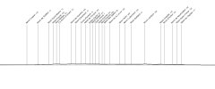
Did part of the White Cliffs of Dover yesterday (from Folkestone to Dover) all by walking (and a quick hop down onto Samphire Hoe). One of the goals (other than getting badly sunburnt) was to view France... though the visibility from far far away was not good. My eyesight barely could see France but I could make out the "lumps" out on the strait horizon. I think In the many photos I made out Cap Blanc-Nez and Cap Gris-Nez but that's what I could find out. I have included a screenshot from Peakfinder from my coordinates at Chapel-Le-Ferne.

I have provided a link in the coordinates to what my geo-tag said it was taken at.
51°05'46.1"N 1°12'07.4"E (Near The Valiant Sailor Pub)
AJFCJaWlTdu7eo1rQ6cSZmoApt6HYQm3mJKz0HSVfC0-ZWQIzCYgLLu6FR7CmAnItIrH881KgvrA8wEKpHGpvKjVFkFFXNMnBp7DUyIdrK1OJhmIQzz5JtnohjpkEXxqP-XVHG0foZCCNtfLnCcEBIahQH19mg=w1273-h955-s-no
AJFCJaVU8Q7IcO2xkFDq4xNhPKyKq6vWY0GFKBdpvO1l8_tarI5FfL9yz7RyqLufuJse9Y0tSA29IE7rRyd_T2zlgMTDrb6INAgfgQBU-kk3ha-5hZRQETMGX-oEzJ2mz303ufxbVquCMzxUzU3EH9X-g3k30w=w1273-h955-s-no


51°06'00.0"N 1°12'48.8"E
(Chapel-Le-Ferne, Near Old Dover Road) Plus PeakFinder view
AJFCJaW2skZzEIugvUTosITTxxFLUtWgByborVgV079f9_JFbbPmlqtG4rICIS81TQljUJ3f5Z-0h72f7FL0GwNs0KhL0W6UPb8dgo8TZdw-u9NbMxI-gnPwsShqLdeLYxoLIMgoxgbtpACDwTCKuA0dcHwKeg=w1273-h955-s-no
1685474573870.png

51°06'31.1"N 1°16'48.4"E
(On top of Shakespears Cliff and Samphire Hoe)
AJFCJaXagykONGh7P2fTECqugDCeEtAH9MkiaAYsfOIq1A8sDqxmX03VGbZGW7XJp_IGo6TP1Pa6JxDIGOqQ_t8VDQAHg1-43LJF18GAZ8wdkhXQXEPX85iTbtfI5o5UzZpPkkEdyEaeFxKlRr-o9-VmiG4GDQ=w1273-h955-s-no


51°06'17.6"N 1°16'34.3"E
(Some benches at samphire Hoe Country Park Car Park)
AJFCJaXq3ke6gvOYZRhgiAuBdh7HiA9eVhyPWNvzpMJKTVMjnZvjfQSWp5AvNhIp1OPHM9Sv7nAMQ8gYmQ9VoWfZl2FHXePC0cozuMNun0n1MsLAfNui6cCWpVsgWrnK8Zhl_eInGpVtkHtjdrfxan8JHbTX8g=w1273-h955-s-no
AJFCJaVDuHIy43y8DqJkxi6YcdXXhVscUf6wQRL4rsCga_a-JVxbZd0tu9CEsDFqiRke-ZriudDOUpruw_3RaoEOnUJGNsfl-HoxEUh4uRqpZgGULxuavvCl6_kr1JTSC9oZH0lJTh5p7cXouljCmOHamjk6qw=w1273-h955-s-no


Last part of the Path near Aycliffe In Dover
AJFCJaW2hI6j_rfR7Y0_KNfzHoGBZNIEWdYT2hQFFI49R88xOh899mRG05b_NcheqtHRgcc_x3UL_XqtkYukhmEDwfjG970Sq-PKTgp1exZeugYXHjOgHIUY_78OqTPPJc2xz42wbv5Uy01mHfTfbPOTAbe0rw=w1273-h955-s-no
AJFCJaWTtgBfkqEdWlwL1L7xFmwgqrDVW_-H5636Lpuit47DdJ8TwadMGpWmnzvtwasqdTmld71kx2QUuWcpcp1gRxc6OKYh3mH6fWspWPFRy956aL7lJi3wXuiQTral4BpfC6Q25RJPBAVBzS0t6Bh6-A7Y9A=w1273-h955-s-no
AJFCJaW8cNQbFPBZ4su3DaIcWtyJsQNNglxGkY6x_dvrUwl3B7p3X3YGWk5Q5grEhY4gJAUG2yredGzRxXbGcpz7nMN7Dxjj-MG8pefKxedv2EUkjTt9z-JZP-2kKZyO1soWw6iaXYaQ8q9ElDfOSIA6_C7noA=w1273-h955-s-no
AJFCJaXkwUPxRtvxFVxJRC2J5yhV-a9ANizae76OBTi6xQXeCWpk9nYW4Ob013AMwbBC_wPw_k2oJhZ1OdbkVM-rV0iggEOb6z6ezoyE-11W5cF_k5fPzBdp2kd7lSjr2F-fBjr5lKhis7-Qsr6lYeGUg7oWMw=w1273-h955-s-no
Sorry if it's more than 2 or 3 photos, most of them weren't that good with the visibility far away, plus my phone camera uses digital zoom. So I couldn't get a good-quality photo or something that stands out.
 

dangie

Established Member
Joined
4 May 2011
Messages
1,276
Location
Rugeley Staffordshire
….One of the goals (other than getting badly sunburnt) was to view France... though the visibility from far far away was not good. …
Out of interest, due to the different topography of the English & French coasts, is it easier to see France from England, or to see England from France?
 

DynamicSpirit

Established Member
Joined
12 Apr 2012
Messages
8,263
Location
SE London
Did part of the White Cliffs of Dover yesterday (from Folkestone to Dover) all by walking (and a quick hop down onto Samphire Hoe). One of the goals (other than getting badly sunburnt) was to view France... though the visibility from far far away was not good. My eyesight barely could see France but I could make out the "lumps" out on the strait horizon. I think In the many photos I made out Cap Blanc-Nez and Cap Gris-Nez but that's what I could find out. I have included a screenshot from Peakfinder from my coordinates at Chapel-Le-Ferne.

Nice photos! Sounds like you were a bit unlucky with the day not being the clearest. I've been at the top of those Cliffs before, and on a clear enough day you can very easily see the green hills rising above the sea on the other side of the English Channel. (And my eyesight isn't brilliant either, so if I can see them... ;) ). But I can well imagine that, any significant haziness could easily destroy visibility over that 20+ mile distance.
 

Taunton

Established Member
Joined
1 Aug 2013
Messages
10,153
Bad luck. I've been at the White Cliffs viewpoint and able to see the tower of Calais Town Hall, with binoculars, and then when I knew just where it was with naked eye. Certainly seeing the whole stretch from Calais to Boulogne, and the low hills behind.

Could that "lump" be a large ship?
 

TheHSRailFan

Member
Joined
16 Jun 2018
Messages
248
To add: I'm being told here and come to the consensus that Mont de Couples and Mont de Sombre are the 2 highest points that can be seen from France. Mont de Couples seem to be a former WW2 lookout and is open to the public and Mont de Sombre is not and is in a farmer's field. Looking to see if I can do Calais in a day so i can try this.
 

TheHSRailFan

Member
Joined
16 Jun 2018
Messages
248
Nice photos! Sounds like you were a bit unlucky with the day not being the clearest. I've been at the top of those Cliffs before, and on a clear enough day you can very easily see the green hills rising above the sea on the other side of the English Channel. (And my eyesight isn't brilliant either, so if I can see them... ;) ). But I can well imagine that, any significant haziness could easily destroy visibility over that 20+ mile distance.
Yeah, I need to basically plan on a clear enough day as well as some more prep to know when it's good or not to view France. My visibility doesn't help thanks to me being short-sighted and on the day seeing floaters, (which weren't enough to be a pest so it didn't annoy me at all) as well as a weird effect that happens from time to time when looking afar and I still haven't gotten to the bottom of. Despite that, I could still view france by searching my hardest and seeing it on the horizon.

I may try again, but it was £31 from doing a return from just north of London to Folkestone on SEHS. So when I get the will or money again, I will most likely try again and prepare myself.

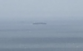
Could that "lump" be a large ship?
That's definitely a ship. Looks like it might be one of the larger ferries?

View attachment 136292
hahaha, this is a ship but it was passing through the strait.

More referring to the just-about seeable cliffs and hills of France in some of the photos.
 

Top