Chris Butler
Member
- Joined
- 23 May 2010
- Messages
- 279
I noticed a spur on Rail Map Online and my Track Atlas in Rugby that appears to go nowhere, but appears to have track in-situ. Is it still used ? if so, for what ?
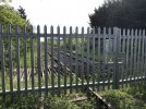
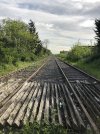
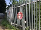
The map below shows it. Rugby station is just off the map to the right. the WCML heads north off the top of the map and the main Rugby - Coventry line heads east off the left side of the map. The spur ends in a suburb call New Bilton, and looks like it may have served the cement plant (now Cemex) or maybe the quarry/gravel pit that it is alongside. It does look like if was severed by the new road junction just past its end. Although the track is visible on Google Maps, there is no evidence of any other infrastructure and the line appears quite overgrown.
Would be grateful for info on what it is/was and whether it is actually in service at all.