• Our booking engine at tickets.railforums.co.uk (powered by TrainSplit) helps support the running of the forum with every ticket purchase! Find out more and ask any questions/give us feedback in this thread!

Shortest length of railway depicted on the 1:25k or 1:50k Ordnance Survey map

Status
Not open for further replies.
Sponsor Post - registered members do not see these adverts; click here to register, or click here to log in
R

RailUK Forums

Western Sunset

Established Member
Joined
23 Dec 2014
Messages
2,511
Location
Wimborne, Dorset
I think the OP specifically mentioned 1:50,000 (1.25in/mile) and 1:25,000 (2.5in/mile) maps. Obviously the larger 25in/mile and 50in/mile OS plans will show shorter, individual lengths of track.
 

endecotp

Member
Joined
23 Apr 2014
Messages
222
A few miniature railways spring to mind, including Poole Park and Cambridge Model Engineering Society, but on checking those are both more than 200 m in total. Can anyone think of any others?
 

PaulJ

Member
Joined
20 Jun 2011
Messages
122
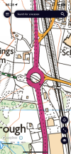
What about the short length of track beneath the A228 roundabout just south of Halling, Kent. It was constructed to serve a nearby quarry and isn't attached to any line, but remains extant.
 
Joined
1 Nov 2021
Messages
115
Location
Berwick
A few miniature railways spring to mind, including Poole Park and Cambridge Model Engineering Society, but on checking those are both more than 200 m in total. Can anyone think of any others?
Ravensprings Park, Brighouse is, but longer, Huddersfield's in Greenhead Park is on but their shorter track at Highfields doesn't which I would say is probably only 175m
 

SussexMan

Member
Joined
23 Oct 2010
Messages
477
What about the short length of track beneath the A228 roundabout just south of Halling, Kent. It was constructed to serve a nearby quarry and isn't attached to any line, but remains extant.
Interesting. Certainly not on the 1:50k but I'm not sure about the 1:25k here. Is it the track or the boundary?
 

Sultan

Member
Joined
6 Mar 2019
Messages
268
This is a screengrab from my OS 50,000 app from my phone (of the Bideford line). There's a solid black line (circled in red) that may well be the railway. It looks separate to the (dashed) boundary line to me.
 

Attachments

  • 1692608558413.png
    1692608558413.png
    817.8 KB · Views: 52

jumble

Member
Joined
1 Jul 2011
Messages
1,114
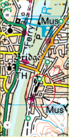
Was recently in Bideford, Devon and saw that the 210m long* Bideford Railway Heritage Centre track is marked on the 1:25k Ordnance Survey map. I'm uncertain whether it is marked on the 1:50k map. It looks like it is but coincides with other markings and appears to be slightly south of where it should be. Are there any shorter lengths of track marked on OS maps?

* As measured on Google Maps
There are some disconnected sidings at Wembley Park on the met that look like they might be smaller
An Stock S8 does not fit in to the individual roads ( 133.68m ) and I doubt it is more than 30 meters to the gap
The Bing map helpfully has a roundel over the gap

 
Last edited:
Status
Not open for further replies.

Top