• Our booking engine at tickets.railforums.co.uk (powered by TrainSplit) helps support the running of the forum with every ticket purchase! Find out more and ask any questions/give us feedback in this thread!

Walking and Rambling discussion

778

Member
Joined
4 May 2020
Messages
382
Location
Hemel Hempstead
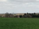
I am planning on having a walk from Goring & Streatly station sometime this year. Have the gantries spoiled the views of the Goring Gap? There is a group that opposes the design of the gantries called "Save the Goring Gap". They wanted Network Rail to install more "aesthetic and landscape sympathetic gantries", but Network Rail did not agree to replace them.
 
Sponsor Post - registered members do not see these adverts; click here to register, or click here to log in
R

RailUK Forums

THC

Member
Joined
21 Sep 2009
Messages
482
Location
Stuck on the GEML
Great Dunmow to Stansted Mountfitchet, 11 miles. There's no such thing as bad weather, only the wrong clothes. So I decided to use my St Patrick's Day to get wet and walk as far as the day would allow. I lasted until the final mile before water seeped into my boots but by then the prospect of a Guinness or two made the soaking worthwhile. Sláinte mhaith! ☘️

THC
 

Attachments

  • IMG_20230317_160002178_HDR.jpg
    IMG_20230317_160002178_HDR.jpg
    4.8 MB · Views: 5
  • IMG_20230317_165115493.jpg
    IMG_20230317_165115493.jpg
    5.3 MB · Views: 12
  • Screenshot_20230317-181218.png
    Screenshot_20230317-181218.png
    517.9 KB · Views: 12
  • IMG_20230317_135224493_HDR.jpg
    IMG_20230317_135224493_HDR.jpg
    5.5 MB · Views: 12

Birmingham

Member
Joined
14 Mar 2020
Messages
502
Location
United Kingdom
Great Dunmow to Stansted Mountfitchet, 11 miles. There's no such thing as bad weather, only the wrong clothes. So I decided to use my St Patrick's Day to get wet and walk as far as the day would allow. I lasted until the final mile before water seeped into my boots but by then the prospect of a Guinness or two made the soaking worthwhile. Sláinte mhaith! ☘️

THC
Brilliant! What kind of topography was that over (i.e. public footpaths through fields, canal towpath, etc.) and is it an ‘official’ route or did you just make it up? :)
 

THC

Member
Joined
21 Sep 2009
Messages
482
Location
Stuck on the GEML
Brilliant! What kind of topography was that over (i.e. public footpaths through fields, canal towpath, etc.) and is it an ‘official’ route or did you just make it up? :)
It's Essex so very easy going. I looked at the map beforehand to plan a route using a few minor roads but mainly public footpaths and green lanes. Dunmow is a very pretty town to start then it's largely open country to Elsenham from where increasingly sodden paths took me under the airport triangle junction and M11 to finish at Mountfitchet. And some nice pubs en route to try next time. :E

THC
 

Birmingham

Member
Joined
14 Mar 2020
Messages
502
Location
United Kingdom
It's Essex so very easy going. I looked at the map beforehand to plan a route using a few minor roads but mainly public footpaths and green lanes. Dunmow is a very pretty town to start then it's largely open country to Elsenham from where increasingly sodden paths took me under the airport triangle junction and M11 to finish at Mountfitchet. And some nice pubs en route to try next time. :E

THC
Sounds great, thank you! May have to try sometime.
 

Birmingham

Member
Joined
14 Mar 2020
Messages
502
Location
United Kingdom
In the same area is the Flitch Way - the course of the railway from Bishops Stortford to Braintree - most of which is walkable.
Yes, I came across that yesterday, thanks! That’s also on the list as I have a bit of a thing for disused railways at the moment. :D

Speaking of, today I walked the Middlewood Way 10 miles from Macclesfield to Marple. Very easily accessible starting from Macclesfield station, and ending at Rose Hill Marple station which would ordinarily also be convenient if it wasn’t for today’s strike!

It’s very easy to walk and you can see remnants of a couple of the stations en route which have been done up nicely with benches and information boards etc.

Starts and ends relatively urban but nice rural countryside in the middle too.
 

Tester

Member
Joined
5 Jul 2020
Messages
577
Location
Watford
Yes, I came across that yesterday, thanks! That’s also on the list as I have a bit of a thing for disused railways at the moment. :D

Speaking of, today I walked the Middlewood Way 10 miles from Macclesfield to Marple. Very easily accessible starting from Macclesfield station, and ending at Rose Hill Marple station which would ordinarily also be convenient if it wasn’t for today’s strike!

It’s very easy to walk and you can see remnants of a couple of the stations en route which have been done up nicely with benches and information boards etc.

Starts and ends relatively urban but nice rural countryside in the middle too.
Very good!

I have done the Middlewood Way, and in fact am on a mission to walk as many disused railways as possible - there are many more which are doable than I thought there would be; still finding!
 
Joined
24 Jul 2011
Messages
447
Location
Wigan
Yes, I came across that yesterday, thanks! That’s also on the list as I have a bit of a thing for disused railways at the moment. :D

Speaking of, today I walked the Middlewood Way 10 miles from Macclesfield to Marple. Very easily accessible starting from Macclesfield station, and ending at Rose Hill Marple station which would ordinarily also be convenient if it wasn’t for today’s strike!

It’s very easy to walk and you can see remnants of a couple of the stations en route which have been done up nicely with benches and information boards etc.

Starts and ends relatively urban but nice rural countryside in the middle too.
I've done that route a few time by bike. Very much recommend!

Not sure if it's still the case, but the Greater Manchester bit (north of the delightful Middlewood station) can get rather muddy at times.
 

Iskra

Established Member
Joined
11 Jun 2014
Messages
8,195
Location
West Riding

_toommm_

Established Member
Joined
8 Jul 2017
Messages
5,890
Location
Yorkshire
Snow is more unlikely in coastal areas as the sea keeps the air - and subsequently land - temperature up.

I was just going off the weather forecast that said it should have had snow and snowed when I was there. I didn't go there specifically for snow, I would have gone much higher.
 

apk55

Member
Joined
7 Jul 2011
Messages
440
Location
Altrincham
Been exploring some of the old railways between Eccles and Bolton recently. Most of the old railway between Patricroft and Bolton has been converted into a walkway (from Monton to near Bolton). Also a walkway is most the line from Patricroft to Clifton with a deviation required via Victoria park where the tunnel was. Another old railway that has been converted to a walkway in the area is the Linnshawe loop an old industrial railway around Blackleach country park.
For my local walking club I recently organized a 10m linear walk from Manchester to Radcliff along the Irwell valley and finished by using the Outwood way (part of the Cifton to Radcliff railway)
 

ChrisC

Established Member
Joined
7 Oct 2018
Messages
1,666
Location
Nottinghamshire
Last Wednesday I did an interesting walk of about 8 miles from Nottingham to Cotgrave. It began at Trent Bridge in Nottingham walking down the side of Nottingham Forest Football Ground and along the south bank of the Trent passing underneath Lady Bay Bridge. This is now a road bridge, but used to carry the main line south from Nottingham to London St Pancras via Melton Mowbray, which closed in 1968 and all trains diverted to the current route via Leicester. After Lady Bay Bridge the walk along the Trent past Adbalton towards the National Water Sports Centre at Holme Pierrepont felt quite rural considering how close it is to Nottingham.

On reaching the National Water Sports Centre I left the riverside and continued along the quiet lane which passes Holme Pierrepont Church and Hall towards Radcliffe on Trent. The Water Sports Centre is set within a country park and is well worth exploring including including walking or cycling around the length of the main water channel. I’ve walked around most of the park on a number of occasions so gave it a miss this time. The walk along the lane was very pleasant passing the large Sky Larks Nature Reserve which I must have a walk around some day.

Just on the outskirts of Radcliffe on Trent, to the left is a view of the railway bridge over the Trent on the Nottingham to Grantham Line. I didn’t continue into Radcliffe but took a right turn onto the relatively new cycle trail and footpath along the old railway that used to go from the Nottingham to Grantham Line up to Cotgrave Colliery. This was quite a good walk because almost the whole route was on a fairly high embankment giving good views over the Trent Valley towards the Gedling and Carlton area of Nottingham and Mapperley Plains beyond there.

On reaching Cotgrave the trail goes into Cotgrave Country Park which is on the site of the old Cotgrave Colliery. The Grantham Canal also runs through this country park and the last section of my walk was along the canal. It is possible to return to Nottingham from here by walking along the side of the Canal towards West Bridgford. It is also possible to continue along the Grantham Canal towards the Vale of Belvoir but bus services back to Nottingham are bit sparse if you walk beyond Cropwell Bishop. By now I had already walked just over 8 miles and knew that even to just walk the 5 miles back along the canal as far as West Bridgford was probably a bit more than I could comfortably manage these days. I decided to catch the Trent Barton bus from Cotgrave back into Nottingham.
 

gabrielhj07

Member
Joined
5 May 2022
Messages
1,048
Location
Haywards Heath
A few loose ends to tie up on the Thames Path brought me to Radley, from where I walked the 7.3 or so miles to Oxford. No trains to either Appleford or Culham, so the Culham-Radley part shall have to wait.

The Thames Path was muddy, and much of it was quite wet. It's all concrete nearer Oxford, but the mud for most of the way made it relatively slow going. Nevertheless an enjoyable walk, and one which afforded the opportunity to tick off a new station - Radley.
 
Last edited:

dangie

Established Member
Joined
4 May 2011
Messages
1,414
Location
Rugeley Staffordshire
Not walking & rambling as such, but a very important part of it.
Weather forecasts......
Considering the unpredictability of the British weather, and the unreliability of the British weather forecasting, is there any particular weather forecasting service you find somewhere near to what they say and to what the weather actually does?
 

Kite159

Veteran Member
Joined
27 Jan 2014
Messages
19,496
Location
West of Andover
A few loose ends to tie up on the Thames Path brought me to Radley, from where I walked the 7.3 or so miles to Oxford. No trains to either Appleford or Culham, so the Culham-Radley part shall have to wait.

The Thames Path was muddy, and much of it was quite wet. It's all concrete nearer Oxford, but the mud for most of the way made it relatively slow going. Nevertheless an enjoyable walk, and one which afforded the opportunity to tick off a new station - Radley.
Appleford to the Thames can be done mostly on footpaths heading west from the station, small section of walking along the road. Culham heading west is a pavement along a busy road.
 

bspahh

Established Member
Joined
5 Jan 2017
Messages
1,805
Not walking & rambling as such, but a very important part of it.
Weather forecasts......
Considering the unpredictability of the British weather, and the unreliability of the British weather forecasting, is there any particular weather forecasting service you find somewhere near to what they say and to what the weather actually does?
Light drizzle doesn't get picked up by rain radar. However, for heavier rain, I find the Accuweather Minutecast pretty good for predictions of the next hour or two. The Met Office Rain Radar is also good. I prefer the Met Office predictions to the Meteosat ones from the BBC. XCWeather is good for the wind over the next few days.

For long distance forecasts I like, WXCharts.com
It shows the 10 day forecasts from ECMWF.int which give a feel for the likely weather. For the longer range forecasts, it might correctly predict that a depression will come through, but get the timing or the track wrong.
 

gabrielhj07

Member
Joined
5 May 2022
Messages
1,048
Location
Haywards Heath
Appleford to the Thames can be done mostly on footpaths heading west from the station, small section of walking along the road. Culham heading west is a pavement along a busy road.
When I last arrived at Culham from the Thames Path, not knowing the area well, I followed the railway north from the river around the side of a field. I shall use the road next time!
 
Last edited:

Iskra

Established Member
Joined
11 Jun 2014
Messages
8,195
Location
West Riding
Did a great, but very windy hike today from Diggle up Broadstone Moss, along to Brockley Hill, around the trio of reservoirs then scrambling up a gulley to The Trinnacle on Saddleworth Moor. We dropped back down to the reservoir level before Dovestone Edge due to excessive wind making it unviable to remain at such height for a long period. We then completed the circuit of the reservoir and headed back to Diggle along the valley bottoms and canal.

A00294C6-3F16-4899-A333-A5B55559F4A5.jpegC71AFB3F-05AE-4E2E-BC30-C909466BED07.jpeg1A74029E-EF0B-4704-A43F-96C0EE9FD7F5.jpeg
32307959-05D4-47DD-8C84-FE800E12AF08.jpeg
 

Kite159

Veteran Member
Joined
27 Jan 2014
Messages
19,496
Location
West of Andover
With the change of weather in Cheshire from being wet most of the day to dry (with a few light short showers) I walked from Middlewich towards Nantwich via the Shropshire Union canal. First couple miles was hard ground before it gave away to grass with the odd area of deep mud & waterlogging. Beautiful scenery in places and quiet as once outside Middlewich the only settlements are small villages.

Plus it goes underneath both the WCML (runs alongside it for a mile) and the Chester - Crewe line. A walk to do in the summer to avoid mud.

Made use of the £2 bus fares to take me to Middlewich from Crewe (originally I going to stay on to Northwich with a crazy bus day) and another £2 fare from Nantwich to Chester.

A 68 heading north crossing the canal, a minute later it got looped by a Pendo.
 

Attachments

  • PXL_20230324_082511577.jpg
    PXL_20230324_082511577.jpg
    2.3 MB · Views: 20
Last edited:

Birmingham

Member
Joined
14 Mar 2020
Messages
502
Location
United Kingdom
With the change of weather in Cheshire from being wet most of the day to dry (with a few light short showers) I walked from Middlewich towards Nantwich via the Shropshire Union canal. First couple miles was hard ground before it gave away to grass with the odd area of deep mud & waterlogging. Beautiful scenery in places and quiet as once outside Middlewich the only settlements are small villages.

Plus it goes underneath both the WCML (runs alongside it for a mile) and the Chester - Crewe line. A walk to do in the summer to avoid mud.

Made use of the £2 bus fares to take me to Middlewich from Crewe (originally I going to stay on to Northwich with a crazy bus day) and another £2 fare from Nantwich to Chester.

A 68 heading north crossing the canal, a minute later it got looped by a Pendo.
Great gen! Seems one of the slightly lesser known canals but looks like one to add to the list to do.
 

High Dyke

Established Member
Joined
1 Jan 2013
Messages
4,314
Location
Yellabelly Country
Friday saw me continue walking the London LOOP, completing Section 10 (Hatton Cross - Hayes & Harlington) and also Section 11 (Hayes & Harlington - Uxbridge). The weather forecast was for rain showers, and when it did rain!

First part of the journey down was to change at Stevenage onto Thameslink service to Farringdon and then Elizabeth Line to Hayes & Harlington. Catch the #90 bus from outside the station to Hatton Cross bus station. Picking up the LOOP from there.

The first part of Section 10 was better underfoot than the previous section, not so waterlogged. The roar of Heathrow soon gave way to the drone of the M4. But you also found some beauty in the green spaces.

Seeking to avoid an approaching thunderstorm I made use of the Tesco store near to the end of section 10.

Venturing on to Section 11, after lunch, saw the rain continue in more prolonged bursts. Escaping the urban environment, albeit briefly, sees the route enter Buckinghamshire before returning into Greater London- the River Colne being the convenient boundary. Rejoining the towpath of the Grand Union canal towards the end of the section makes for pleasant canalside views, although in some places the paths were fairly muddy.

20230324_113356.jpg20230324_122101.jpg20230324_125635.jpg20230324_142222.jpg 20230324_142645.jpg 20230324_150031.jpg 20230324_163021.jpg 20230324_175641.jpg
 

THC

Member
Joined
21 Sep 2009
Messages
482
Location
Stuck on the GEML
Heh. And I thought I was taking the piss when I could say that I'd completed my first entire canal in the Regent's Canal (8.6 miles)!
Given your username, have you walked the BCN or the other West Midlands canals? So much contrast and a great way to see the region. I thoroughly recommend. :E

THC
 

Kite159

Veteran Member
Joined
27 Jan 2014
Messages
19,496
Location
West of Andover
Another canal walk today with the Trent & Mersey canal from Kidsgrove towards Sandbach (mainly to fill in some gaps from a couple of weeks ago when I did the disused railway route from Alsager towards Sandbach which involved the canal towpath).

The first 4 or so miles from Kidsgrove was on hard ground, a few puddles from the rain recently (threw it down in Crewe last night). Afterwards, the hard surface gave way to grassy mud, some areas worse than others but no real deep patches like I had on Friday on the Middlewich canal. Certainly some nice views of the countryside along the way.

After arriving in the Ettiley Heath area of Sandbach, near the railway bridge, I turned left to head towards Crewe. A route best done in the summer as it was seriously muddy in places, especially on sections where the path had some steep slopes and little to hold onto for support to prevent falling over. Overall some nice views of the countryside, although the middle section was across some fields (slightly waterlogged) was more a case of trying to spot the gate as what the OS map says is the route wasn't the actual route. I was glad when I reached the road in Maw Green for some solid ground!

I was originally going for the disused railway line from Newport to Stafford, but the engineering works timetable SWR was running today was a bit rubbish.
 

dangie

Established Member
Joined
4 May 2011
Messages
1,414
Location
Rugeley Staffordshire
Last Thursday wifey & I walked through Newborough Forest on Anglesey down and onto Ynys Llanddwyn (Llanddwyn Island). Had to wait about an hour for the high tide to recede before we could cross onto the Island. Extremely windy which made for a very rough sea. Great views. Wonderful walk of over 8 miles in total.
 

Birmingham

Member
Joined
14 Mar 2020
Messages
502
Location
United Kingdom
Given your username, have you walked the BCN or the other West Midlands canals? So much contrast and a great way to see the region. I thoroughly recommend. :E

THC
Ooh, let's see — I've done:
  • Birmingham Main Line Canal (both variations) from Birmingham to Wolverhampton
  • Worcester & Birmingham Canal from Birmingham to Alvechurch
  • Birmingham & Fazeley Canal from Birmingham to Tamworth
  • Dudley Canal from Halesowen to Windmill End Junction then Netherton Tunnel to the Main Line Canal
  • Grand Union Canal from Birmingham to Daventry (then MK to Berko — I'm working on the bit in-between!)
Totally agree re. contrast. They're all great but for vastly different reasons!
 

RichJF

Member
Joined
2 Nov 2012
Messages
1,106
Location
Sussex
Went up the North Downs (Gravelly Hill to Merstham). Shameful to say it was the 1st time doing that section despite growing up in Redhill!!!!! :rolleyes:

I used to go to primary school in Bletchingly & always wondered what those 4 different masts on the top of the hills were as a kid! Now I found out: 2 radio broadcast towers at Gravelly & 2 repeater stations on Pilgrim's Lane!
 

Attachments

  • IMG20230402133824.jpg
    IMG20230402133824.jpg
    4.4 MB · Views: 6
  • IMG20230402143747.jpg
    IMG20230402143747.jpg
    3.3 MB · Views: 6
  • IMG20230402141105.jpg
    IMG20230402141105.jpg
    1.5 MB · Views: 6

THC

Member
Joined
21 Sep 2009
Messages
482
Location
Stuck on the GEML
Sheringham to Kings Lynn, 65 miles over 3 days:

Sheringham to Wells-next-the-Sea, 20 miles - day 1. The northern part of the Norfolk Coast Path was hard work, not only to stay ahead of the rain but to walk for what felt like forever on the shingle. My legs were on fire but a couple of pints at the Golden Fleece and fish and chips from French's to finish and all was right with the world again.

Wells-next-the-Sea to Hunstanton, 23.8 miles - day 2. Up early for the western part of the Norfolk Coast Path to break for shelter when needed from the promised rain. Thankfully it largely stayed away, apart from an hour's soaking when I was out on the salt marshes. Despite hugging the coastline, the walk faced mostly inland, finishing with a few miles along the sand dunes to end where the railway once ran to Hunstanton.

Hunstanton to Kings Lynn, 20.7 miles - day 3. From Hunstanton, where preparations were in train for the soapbox derby, I headed south along the sea wall for seven miles before turning inland to Dersingham and the Sandringham estate. I saw as much as I could without paying before picking up the Sandringham Railway Path all the way to the end at Lynn railway station. The Hanseatic splendour of the town will wait for another day. Time to go home.

THC
 

Attachments

  • Screenshot_20230403-084613.png
    Screenshot_20230403-084613.png
    383.1 KB · Views: 10
  • Screenshot_20230403-084650.png
    Screenshot_20230403-084650.png
    393 KB · Views: 10
  • Screenshot_20230403-084721.png
    Screenshot_20230403-084721.png
    407.7 KB · Views: 10

Top