DynamicSpirit
Established Member
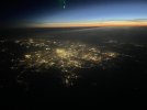
I took this photo 5 years ago (24 August 2018 to be exact) from the top of the cliffs at Dover, with a camera that had a high optical zoom. It's pretty hazy but shows what you can in principle see:

On Twitter there are some very good photography accounts based in Liverpool, and one account is by a chap called Phil Mottram (account name: @ElektroBorho). He has captured some shots over the weekend taken from Everton Brow and has captured Snowdonia at sunset.
Snowdon can be seen to the left of the Snowdonia peaks, with the Glyders, Tryfan, and the Carneddau also in shot.
View attachment 127882View attachment 127883
But Caesars Camp I think is technically Surrey, atleast on the border of it anyway. So maybe you can’t see London from Hampshire.
I was interested in this one having mentioned Caesars camp / London further up the thread. I didn't think about the 'border' issue when I visited so have checked the map. It seems odd that the Eastern end on the hill fort (from where you get the best view of London) is in Hampshire. Odd in the sense that Surrey is the closer county to London. All sorts of oddities to explore in county boundaries.the border runs right through the middle of Caesar’s camp. There’s a good chance that with careful positioning and a wide stance you can see London from Hampshire and Surrey concurrently.
The transmitter in that picture is the Moel-y-Parc transmitter that’s located on the Clwydian hills. The view is looking west, and Winter Hill would be in the opposite direction behind the photographer.The views of London from Caesars camp , near Aldershot , well I was going to say that means you can see London from Hampshire. That’s the only line of sight of London I think you can see from anywhere in the county of Hampshire.
But Caesars Camp I think is technically Surrey, atleast on the border of it anyway. So maybe you can’t see London from Hampshire.
First attachment photo,is that the Winter Hill transmitter near Bolton, behind Liverpool ?

To add: I'm being told here and come to the consensus that Mont de Couples and Mont de Sombre are the 2 highest points that can be seen from France. Mont de Couples seem to be a former WW2 lookout and is open to the public and Mont de Sombre is not and is in a farmer's field. Looking to see if I can do Calais in a day so i can try this.
On the top of Broadway hill in Worcestershire sits Broadway tower. From here it is said you can see 16 counties. I've never been experienced enough to count them but it certainly is a stunning view on a clear day. Also from Stroud in Gloucestershire you can see both the Severn bridges, another fantastic view when the light conditions are perfect.
Can you see Hampshire from the Broadway Tower? I am thinking of the hills near Newbury.On a vaguely related point, and I think I posted this some time ago, according to a dynamic panorama generator, the most northwesterly point in the UK that you can see France is allegedly Willingdon Hill, above Eastbourne - though I believe you can also see it from the top of the Chillerton Down transmitter on the Isle of Wight.
From Willingdon Hill you can apparently see Mont Lambert above Boulogne in very clear conditions. It's pretty much exactly 100km.
This was the site I used:
Generate a panorama
Alpenpanoramen erzeugen, Berge identifizieren, Gipfel identifizieren, Bergpanoramen erzeugen, identification of summitswww.udeuschle.de
Further north, France can also be seen from the Brightling Obelisk, not far from Robertsbridge.
(I've never heard of this viewpoint before, but looks like it's a notable one - as well as a distant view of France in clear weather, you can also see a good part of the escarpment of the South Downs as far west as Littleton Down, near Petworth).
Just guessing what they might be, though the Welsh ones have changed quite a bit over the years so they might be more ambiguous. Also do we include metro counties such as the West Midlands?
Assuming the 1974 counties with the modification of Worcestershire and Herefordshire being separate, my guess would be:
Worcestershire, Gloucestershire, Oxfordshire, Warwickshire, Herefordshire, Shropshire, West Midlands, Staffordshire, Northamptonshire, Buckinghamshire, Berkshire, Wiltshire, Powys, Gwent, Leicestershire - that's 15. I guess using different Welsh counties would increase it.
Can you see Hampshire from the Broadway Tower? I am thinking of the hills near Newbury.
Was talking about this to a friend who lives in the area. On a good day using a radio with the right conditions, he can get French radio stations. I only found out tonight that from Willingdon Hill, you can view 'Mont Lambert' which has a transmission tower on it.On a vaguely related point, and I think I posted this some time ago, according to a dynamic panorama generator, the most northwesterly point in the UK that you can see France is allegedly Willingdon Hill, above Eastbourne - though I believe you can also see it from the top of the Chillerton Down transmitter on the Isle of Wight.
From Willingdon Hill you can apparently see Mont Lambert above Boulogne in very clear conditions. It's pretty much exactly 100km.
udeuschle was what I used originally in my original post, but I find it more fidgety and time-consuming. I now basically use PeakFinder which I have discovered it is inferior, but gets the job done.This was the site I used:
Just checked and im not too sure about this one, can't find info that its possible to view France from here.Further north, France can also be seen from the Brightling Obelisk, not far from Robertsbridge.
(I've never heard of this viewpoint before, but looks like it's a notable one - as well as a distant view of France in clear weather, you can also see a good part of the escarpment of the South Downs as far west as Littleton Down, near Petworth).
Was this an actual sighting? (I ask because, here at least, the air was exceptionally clear yesterday).Was talking about this to a friend who lives in the area. On a good day using a radio with the right conditions, he can get French radio stations. I only found out tonight that from Willingdon Hill, you can view 'Mont Lambert' which has a transmission tower on it.
udeuschle was what I used originally in my original post, but I find it more fidgety and time-consuming. I now basically use PeakFinder which I have discovered it is inferior, but gets the job done.
Just checked and im not too sure about this one, can't find info that its possible to view France from here.
No, he lives in Hailsham and is just something he picks up on his radio. Could have tried yesterday in trying to spot France if things were good yesterday!Was this an actual sighting? (I ask because, here at least, the air was exceptionally clear yesterday).
I've been to Willingdon Hill twice, but on neither occasion was the air clear enough to see that far.
I see, Guess it's something you have to try on a clear day because of how far the Obelisk and the French coast are.(Brightling Obelisk) This was based on using the udeuschle site. Also apparently visible were two more French hills, closer to Calais: Mont Couple and another (forgotten the name of the second).
Alderney and Guernsey look to be much the same distance from Devon. Alderney has the advantage here that its facing coast is elevated. Guernsey's facing coast is low lying.A surprising line of sight across The Channel was used in older television days by ITV to transmit to the Channel Islands before there was an effective alternative, they erected a microwave transmitter in south Devon, focused directly to a receiver on Alderney (100ft high I believe), the nearest Channel Island and just off Cherbourg in France, from where it was relayed to the other islands, and was the main basis for Channel Television, which was the independent commercial company for the islands. Now I would not have believed that from Devon you could point at something on the Channel Islands (albeit both ends elevated), and microwaves only travel in dead straight lines, but this worked for some years from the 1960s until a more sophisticated arrangement was available. Apparently the picture was sometimes lost for a moment if birds flew in front of the aerials.
"Superior Mirage" where things below the horizon appear (or things on the horizon like ships appear to be floating in the air?) due to atmospheric conditions? Although 80 miles doesn't preclude mountains being visible, perhaps Panorama never picked that up?Late to this thread, and I haven't tried to read every entry, so if this has been mentioned, apologies!
After the first covid lockdown, a few days after it become permissible to travel into Wales (Dyfed Powys Police had operated frontier patrols), I walked up Hay Bluff. I had been longing to do so throughout lockdown - I can see it from my desk.
It was a sparkling, clear day. And to my surprise, Y Wyddfa (Snowdon) was clearly visible, about 80 miles away. Interestingly, this isn't identified on panorama web site named in post 1.
I don't think so....that will be the somewhat lower Penhill (553 metres above sea level) on the South side of Wensleydale about 5.5 miles South West of Leyburn.I've been meaning to ask... someone told me they thought they could see Pen-y-Ghent from a train on the East Coast Main Line in the Thirsk / Northallerton area on a clear day with no mist in the air; is that possible or is he - as I suspect - actually looking at a much nearer but similarly shaped hill?
Thank you; I thought it might be something much nearer.I don't think so....that will be the somewhat lower Penhill (553 metres above sea level) on the South side of Wensleydale about 5.5 miles South West of Leyburn.
")

 www.alamy.com
That’s a great picture. I always like it when I catch a glimpse of distant structures illuminated, and it’s usually transmitters that I catch sight of.I've been looking into the magical 40 miles from the Shard. There's a viewpoint somewhere on Sheppey where someone's been able to snap the Shard from.
As I'm unable to find the exact location, I'm unable to confirm if this does or doesn't exceed 40 miles.Minster on Sea, Kent, UK. 10th October, 2020. The illuminated tip of The Shard - London's tallest landmark - seen from an incredible 40 miles away in Minster on Sea on the Isle of Sheppey, Kent this evening. Credit: James Bell/Alamy Live News Stock P
Download this stock image: Minster on Sea, Kent, UK. 10th October, 2020. The illuminated tip of The Shard - London's tallest landmark - seen from an incredible 40 miles away in Minster on Sea on the Isle of Sheppey, Kent this evening. Credit: James Bell/Alamy Live News - 2D4R3JW from Alamy's...
 www.alamy.com
Snaefell on the isle of man can also be seen on both the seafront and tower.One thing I noticed on my last visit to Blackpool is that both the mountains of Snowdonia and the Lake District can be seen from the seafront path - I thought you could only see them from the Blackpool Tower or from the Big One's lift hill.
Whilst riding the Big One I noticed that you can see the Liver Building, Paddy's Wigwam and Liverpool Cathedral.