Railways are very beautiful things
Indeed so! Perhaps someone should build a new one in Bedford…
Railways are very beautiful things
The Oxford Mail will write whatever they think will get the most clicks, unfortunately.The Oxford Mail are reporting that there'll need to be a 14 week closure over the winter, possibly over Christmas, for preparatory work to move utilities before the bridge work next summer:

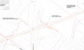
14-week closure of Botley Road could hit Christmas shopping
Oxford's Christmas shopping traffic could be disrupted by a 14-week closure of Botley Road, one of the city's busiest routes.www.oxfordmail.co.uk
Thanks for providing link. Very informative and not seen this software thats driving it before but good how it seamless integrates all media types in a single document.Not much activity on the forum recently, hopefully this link will provide some interesting reading with several presenations to look at. Here is the latest EWR2 Project Newsletter for Summer/Autumn 2022.
EWR2 Project News Letter Summer/Autumn 2022
With track construction works scheduled for completion by Autumn 2023, the project focus will then turn to the final phase of rail control systems implementation, with Signalling, Power and Telecoms (SP&C) equipment being installed lineside and at the control centre in Rugby. This will be the final stage of the project, before system commissioning and hand over of the finished railway to infrastructure owner and operator Network Rail.
7 Signalling & Telecoms DNO supplies have already been installedThe Summer/Autumn newsletter has quite a bit about the construction progress, and when they're intending to lay track where. One summary on the overall timelines was:
Should stay the same I think.Will the existing signalling boundaries be maintained in the final setup, ie will a train from Oxford heading to Bletchley still come under control of Marylebone between south of Wolvercot tunnel and Bicester (Gavray Jn is it?) - or will there possibly be further changes of responsibility?


I think looking at all the separate nozzles it’s most likely to be for wetting ballast in delivery wagons, for washing the trains themselves you’d probably want stuff on the sides as well.Great pictures!
I might be completely wrong about this, but the scaffolding in the second image seems to me to be for a water supply system, rather than sensors. Do they need tankers of water for any part of the track-laying process? Dust mitigation during ballast laying, I wonder? Or is it a sort of carwash?
That makes perfect sense, preventing dust pollution, and this would be the arrival road.Great pictures!
I might be completely wrong about this, but the scaffolding in the second image seems to me to be for a water supply system, rather than sensors. Do they need tankers of water for any part of the track-laying process? Dust mitigation during ballast laying, I wonder? Or is it a sort of carwash?
Don't know - but if the line is bidirectional when it's opened, this would be the first chance to take something over to wrong line working after leaving Bicester on the normal line. According to Traksy, the Gavray junction EWR->Oxford line is a crossover at Gavray Jct not a ladder.I think looking at all the separate nozzles it’s most likely to be for wetting ballast in delivery wagons, for washing the trains themselves you’d probably want stuff on the sides as well.
Edited to add:
Another question though, is the crossover in the first of the latest pictures likely to be permanent or just temporary, as the track layout in post #629 doesn’t show it? Or is it possible that diagram is just showing that Bicester Village is off to the right somewhere, given it’s not included Gavray Junction either…
If it was ever going to be it got binned off early on, I can't remember seeing a signalling plan with it on.I think that EWR from Bicester towards Bletchley will not now be bi-directional. Since the most recent signalling changes in August 2021, Signal OB1787 at Bicester Village now only has a position 4 junction indicator for the route towards Bicester South Jn and Marylebone. This route used to be position 5 (4 previously being towards Bletchley ie down direction on the up line).
Before and after signalling changes at Bicester Village. First picture (August 2021) shows the route set towards Marylebone. The second picture is dated November 2021.
I think traksy must have had difficulty simplifying it, because they’ve decided to draw the Marylebone route as straight ahead, but as we know on the ground it’s an almost straight route towards EWR with the down Bletchley to up Marylebone weaving over on a ladder.That makes perfect sense, preventing dust pollution, and this would be the arrival road.
Don't know - but if the line is bidirectional when it's opened, this would be the first chance to take something over to wrong line working after leaving Bicester on the normal line. According to Traksy, the Gavray junction EWR->Oxford line is a crossover at Gavray Jct not a ladder.
.jpg")
.jpg")
.jpg")
.jpg")
In the first picture there’s actually two completely separate bridges visible, the flat concrete beam bridge in the foreground is the new bypass bridge, replacing Charbridge Lane level crossing, and the dark blue brick bridge is on the Bicester Road leading to Launton village, and it’s actually about 150 yards further behind it. Please note the separate shadows of two bridges on the tracks and ballast, thats 150 yards in real life!I'd assume it has to be, as surely you wouldn't build a new bridge that couldn't, but is that new arched bridge really high enough for electrification clearances? Or is it just a trick of perspective that makes it look like the Class 66 will barely squeeze under?
I'd assume it has to be, as surely you wouldn't build a new bridge that couldn't, but is that new arched bridge really high enough for electrification clearances? Or is it just a trick of perspective that makes it look like the Class 66 will barely squeeze under?
Ah, thank you. The description on the photo didn't make it clear to me there were two bridges there.In the first picture there’s actually two completely separate bridges visible, the flat concrete beam bridge in the foreground is the new bypass bridge, replacing Charbridge Lane level crossing, and the dark blue brick bridge is on the Bicester Road leading to Launton village, and it’s actually about 150 yards further behind it. The nearer bridge being brand new does give electrification clearance, the brick bridge doesn’t, because it wasn’t rebuilt, it just had its parapets heightened.
But in general, only the new bridges along the route are clear for electrification.
Ah, thank you. The description on the photo didn't make it clear to me there were two bridges there.
I reckon the first photo covers a huge distance, you can just see a strip of green under the second arched bridge, so that must be the next new footbridge, where you took photos 2 and 3 from. If I’ve got my bearings right it also shows one abutment of the new Launton Station Road bridge. That’s about 2.25 km from the Jarvis Lane footbridge you are standing on…Apologies, I’ve edited the text to make it clearer.
I think the NR boundary is generally positioned so that built earthworks such as embankments and cuttings are under NR control, including all the dedicated drainage. Nowadays they also ideally allow for an access route for maintenance vehicles.Great pictures <fishwomp> and <II>.
I guess the ballast under the approach to crossing HS2 not changed in 6 months may benefit from settling/ compacting; and II's shots suggest more 'levelling up' to come?
I note some pix suggest railway boundaries are a long way from the track. Is there a legal minimum- no sparks/ cinders from steam!!? Maybe the additional 'value' from the land is not worth the cost of legal transfer and moving fences?