swt_passenger
Veteran Member
- Joined
- 7 Apr 2010
- Messages
- 31,442
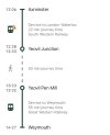
“Independent transfer” perhaps?It should be allowing an hour in between trains - the fixed link is 50 minutes with a further 5 minutes at each station.
I think there is an argument that this could be made clearer. As for available methods, these will vary according to time of day and day of the week, so I don't think that information can be easily provided.


")