• Our booking engine at tickets.railforums.co.uk (powered by TrainSplit) helps support the running of the forum with every ticket purchase! Find out more and ask any questions/give us feedback in this thread!

Walking and Rambling discussion

Kite159

Veteran Member
Joined
27 Jan 2014
Messages
19,269
Location
West of Andover
I walked Braunston to Leamington along the Grand Union Canal at the end of August. Only just passable in places due to overgrown vegetation, and in a couple of places the towpath had all but collapsed. I certainly wouldn't want to walk it atthis time of year.
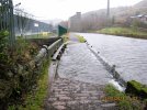
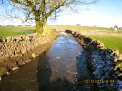
Something for me to bear in mind if I get round to doing that section next year. Not good when the towpath has disappeared.

I have a saying when it comes to barely passable paths (i.e. Weaver Navigation), "engage bulldozer mode"
 
Sponsor Post - registered members do not see these adverts; click here to register, or click here to log in
R

RailUK Forums

Albaman

Member
Joined
16 Sep 2018
Messages
90
The mention of canal towpaths , reminded me of a walk I undertook two months ago which, the route I don't think has been mentioned, or , at least, not recently.

I set off from Lancaster station and, after a mile or so, joined the trackbed of the former branch line to Glasson. On arrival at Glasson, I walked along the towpath of the Glasson branch of the Lancaster Canal until the point where it joined the " main Line ". From there, I headed north , returning to Lancaster city centre. The towpaths were in good condition, although rather narrow in places. The distance was approximately 13 miles but one of the party left the group at Galgate ( just north of the canal junction ) from where he caught one of the fairly regular buses to Lancaster Bus Station.
 

ChrisC

Established Member
Joined
7 Oct 2018
Messages
1,616
Location
Nottinghamshire
The mention of canal towpaths , reminded me of a walk I undertook two months ago which, the route I don't think has been mentioned, or , at least, not recently.

I set off from Lancaster station and, after a mile or so, joined the trackbed of the former branch line to Glasson. On arrival at Glasson, I walked along the towpath of the Glasson branch of the Lancaster Canal until the point where it joined the " main Line ". From there, I headed north , returning to Lancaster city centre. The towpaths were in good condition, although rather narrow in places. The distance was approximately 13 miles but one of the party left the group at Galgate ( just north of the canal junction ) from where he caught one of the fairly regular buses to Lancaster Bus Station.
A lovely walk that one. I remember doing it about 10 years ago when I was staying with friends near Blackpool. The canal part of the walk was nice but I really loved the walk down the old railway track from Lancaster to Glasson with great views of the Lune Estuary. It was a very warm spring day and and I stopped for a break by the estuary watching birds. Great views of the estuary and Glasson Dock was an interesting place to wander around too. Like one of your party I finished the walk in Galgate from where I caught the bus back towards Blackpool.
 

Kite159

Veteran Member
Joined
27 Jan 2014
Messages
19,269
Location
West of Andover
The mention of canal towpaths , reminded me of a walk I undertook two months ago which, the route I don't think has been mentioned, or , at least, not recently.

I set off from Lancaster station and, after a mile or so, joined the trackbed of the former branch line to Glasson. On arrival at Glasson, I walked along the towpath of the Glasson branch of the Lancaster Canal until the point where it joined the " main Line ". From there, I headed north , returning to Lancaster city centre. The towpaths were in good condition, although rather narrow in places. The distance was approximately 13 miles but one of the party left the group at Galgate ( just north of the canal junction ) from where he caught one of the fairly regular buses to Lancaster Bus Station.
Something which has been on my list of potential walks next year, bit of a mix of old railway line & canal towpath.

-----

Yesterday (Sunday) I risked the weather to do a loop from Hamworthy, heading towards Wimborne on the trackbed of the old Southampton & Dorchester Railway route (part of cycle network 25, Castleman Trail), before an old road & some quiet country lanes to pick up an old roman road in Happy Bottom which I followed back towards Hamworthy (passing underneath my outward journey in the Upton Heath Country Park). After arriving back near the start at the beautiful Upton Country Park I followed the path along the edge of "Holes Bay" to reach Poole station. Might have got a bit wet on the final section but the timings at Hamworthy station just didn't work out (would have missed the train by a minute, had it been on time).
 
Last edited:

High Dyke

Established Member
Joined
1 Jan 2013
Messages
4,283
Location
Yellabelly Country
So continuing with the Macclesfield Canal, I reconvened on Monday at Congleton. The weather was sunny, but breezy - brought on by Storm Debi. I retraced my way to the nearby Queens Head pub, where there is direct access to the towpath via some steep stairs. Taking in a meandering route, as canals tend to do, saw me cross the route of the closed Biddulph Valley railway, now a footpath. The route then crosses the River Dane on an ornate aqueduct before entering the Bosley Lock flight. These locks alter the height of the canal by about 118 feet, in the space of a mile. Approaching Gurnett there's a cottage where engineer and canal builder James Brindley lived. The pub also has access ( via steps) to the towpath. Entering Macclesfield you pass the old Hovis Mill, now redeveloped. I finished the walk at this point for the day.
20231115_165719.jpg 20231113_172502.jpg 20231115_165648.jpg 20231113_172412.jpg
Images show the railway viaduct over the River Dane. The canal aqueduct over the River Dane. The bridge over the canal that carried the North Staffs Railway - Churnet Valley line and splendid engineering approaching Macclesfield.

Resuming on Tuesday morning I continued towards Marple. Passing through Bollington you find two converted mill buildings. Adelphi Mill produced silk. Clarence Mill was a cotton mill. The latter has a café well worth a visit. After tea and cake I pushed onwards through rural Cheshire. Around High Poynton it began to rain, a test for the wet weather gear. Just beyond High Lane the canal passes over the LNWR line to Buxton. Passing another mill on the fringe of Marple, I arrived at the end of the canal as it joins the Peak Forest Canal; predictably in another downpour.
20231115_162949.jpg 20231115_165817.jpg 20231115_165843.jpg
Images show: Clarence Mill, Bollington. LNWR line to Buxton and the junction of the Macclesfield Canal and Peak Forest Canal at Marple.
 

Iskra

Established Member
Joined
11 Jun 2014
Messages
7,948
Location
West Riding
I enjoyed a beautiful, crisp but sunny winter morning walk around Langsett reservoir on the edge of the Dark Peaks, not too far from Stocksbridge this morning. It’s just a nice distance for a winter walk, but I like that it’s not just around the shores of the reservoir but it takes in some moorland too.

Best of all, the logical route finishes at Bank View Cafe, where a cracking full English was enjoyed. A pub is also available too. It’s best visited by car, but there are 3 buses on a Saturday-only if anyone wants to try that obscure route!


IMG_3313.jpegIMG_3311.jpegIMG_3312.jpegIMG_3310.jpegIMG_3307.jpeg
 

S&CLER

Member
Joined
11 Jan 2020
Messages
785
Location
southport
Great pics, thank you for sharing. I've walked most of the British canal network but the Rochdale Canal above Rochdale itself still remains to be done. Your pics have whetted my appetite!

THC
I was in Todmorden recently on a foul day and found this bit of towpath especially worrying
 

Attachments

  • 13.JPG
    13.JPG
    738.9 KB · Views: 55

ChrisC

Established Member
Joined
7 Oct 2018
Messages
1,616
Location
Nottinghamshire
I managed a good New Year’s Day walk yesterday morning before the heavy rain returned later in the day. Quite local to me, this was a walk up in the hills south of the villages of Farnsfield, Edingley and Halam in Nottinghamshire, which are just to the west of Southwell. I’ve walked the Southwell Trail to the north of these hills on many occasions but chose to walk some of the quiet country lanes and farm tracks to avoid the floods, waterlogged fields and deep mud. It was great to be out walking in the winter sun with clear blue skies after so much rain.

It was only a walk of around 6 miles in length but good to get out and about walking in an area I know very well only a few miles from home. It once more made me realise that I don’t have to walk far away from home to enjoy lovely countryside and also just how underrated the villages and countryside of Nottinghamshire is. Perhaps its best that it should remain quiet and undiscovered.

It was dry underfoot on the country lanes up in the hills but many of the lanes in the valleys had deep puddles and in places were quite badly flooded. Some of the farm tracks had deep puddles and mud to get through. I passed a number of fallen trees from the recent gales. Lots of the fields at lower levels had standing water and water running off the fields onto the lanes. Hopefully after more heavy rain today there will be a few days of dry weather to allow everywhere to dry out a bit.

IMG_6121.jpeg
 

S&CLER

Member
Joined
11 Jan 2020
Messages
785
Location
southport
One of the walks I most enjoyed recently was a half-recce from Millers Dale to Tideswell (I'd done Peak Forest to Millers Dale the week before) on 2 December, a freezing day, and especially cold in the shady valley of the Derbyshire Wye between Millers Dale and Litton Mill. The picture shows a completely frozen green lane (Slancote Lane)
 

Attachments

  • 32.JPG
    32.JPG
    775.9 KB · Views: 13

ChrisC

Established Member
Joined
7 Oct 2018
Messages
1,616
Location
Nottinghamshire
One of the walks I most enjoyed recently was a half-recce from Millers Dale to Tideswell (I'd done Peak Forest to Millers Dale the week before) on 2 December, a freezing day, and especially cold in the shady valley of the Derbyshire Wye between Millers Dale and Litton Mill. The picture shows a completely frozen green lane (Slancote Lane)
I did part of that walk a few months ago during much warmer weather. I really liked the lane beside the river between Millers Dale and Litton Mill but can imagine how cold it could be in winter. It is in such a deep valley that would get no sun in winter. I didn’t walk up into Tideswell but continued walking along the riverside path to Cressbrook. Lovely area.
 

S&CLER

Member
Joined
11 Jan 2020
Messages
785
Location
southport
I did part of that walk a few months ago during much warmer weather. I really liked the lane beside the river between Millers Dale and Litton Mill but can imagine how cold it could be in winter. It is in such a deep valley that would get no sun in winter. I didn’t walk up into Tideswell but continued walking along the riverside path to Cressbrook. Lovely area.
I have 2 great images of the valley in freezing conditions, almost all ice blue, but the file sizes were too large for me to post unfortunately. Those pictures were taken on my "proper" camera, an Olympus EM-10, a nice light mirrorless camera just the right size and weight to take on walks, usually with a 12-60 mm lens; whereas the one I posted was taken on the "recce" camera, an old Canon Ixus which is a compact that sits comfortably on my belt but has a viewfinder (I find this essential) and still prints the time on the image if I shoot in postcard mode. I find this feature very useful for planning walks I am going to lead, as I take a photo of every waymark (stile, gate, fingerpost, road or path junction etc.) and can assess the time the walk will take. Now I at last have a colour printer, I may start printing contact sheets of all the waymarks in the proper sequence as an aide-memoire to use while leading. Or if I do yield to pressure and finally get a smartphone (as I may tomorrow), I suppose I could just take that with me; but I detest seeing people with their faces buried in phones while out walking. Some leaders seem to do that, but for me the mark of success as a walk leader is to recce the walk so thoroughly that I can do it all from memory without even looking at a map. I confess that I very often enjoy my solitary recces much more than leading a chatty group, but that's just my unsocial nature (Asperger's strikes again). The attachment shows the sharp contrast between the valley in shade and the higher part in full sun.
 

Attachments

  • 07.JPG
    07.JPG
    1.1 MB · Views: 12

Iskra

Established Member
Joined
11 Jun 2014
Messages
7,948
Location
West Riding
Had a stunning walk along Hadrians wall today from Housesteads Fort past the infamous Sycamore Gap to Steel Rigg car park. I followed the wall for the first half but then came off it and walked parallel with it about 1km North of it, which gave a different perspective and you see what an impressive frontier barrier it was.

IMG_3791.jpegIMG_3797.jpegIMG_3836.jpegIMG_3804.jpeg
 

THC

Member
Joined
21 Sep 2009
Messages
471
Location
Stuck on the GEML
Marks Tey to Long Melford, 18.2 miles. I loosely followed the Gainsborough line from Marks Tey through Chappel, Wakes Colne, all the Bureses (?), then skirted Sudbury before picking up the old railway trackbed to Long Melford, criss-crossing the Essex-Suffolk border on the way. Just what I needed after a tough start to the year.

THC
 

Attachments

  • IMG_20240129_093333381.jpg
    IMG_20240129_093333381.jpg
    2 MB · Views: 22
  • IMG_20240129_110749765.jpg
    IMG_20240129_110749765.jpg
    2.4 MB · Views: 16
  • IMG_20240129_151649289.jpg
    IMG_20240129_151649289.jpg
    4 MB · Views: 22
  • Screenshot_20240129-160358.png
    Screenshot_20240129-160358.png
    478.1 KB · Views: 18

THC

Member
Joined
21 Sep 2009
Messages
471
Location
Stuck on the GEML
Sudbury to Elmswell, 22.8 miles. I headed to the high ground of west Suffolk, such as it is, for a day away from it all. And what a day, such splendid isolation. Lots of churches, two Roman roads and only one boot full of water. Oh, and the place names. Brent Eleigh, Kettlebaston, Rattlesden and Woolpit. Fabulous.

THC
 

Attachments

  • IMG_20240210_082103782.jpg
    IMG_20240210_082103782.jpg
    5.1 MB · Views: 17
  • IMG_20240210_110133768_HDR.jpg
    IMG_20240210_110133768_HDR.jpg
    3.4 MB · Views: 12
  • IMG_20240210_163902884_HDR.jpg
    IMG_20240210_163902884_HDR.jpg
    4 MB · Views: 16
  • Screenshot_20240210-163013.png
    Screenshot_20240210-163013.png
    580.3 KB · Views: 16

johnnychips

Established Member
Joined
19 Nov 2011
Messages
3,679
Location
Sheffield
Last week I thought I’d better shake off post-Xmas lethargy, jumped on a bus to the Peaks and did the Monsal Trail from Haddon Hall to Wyedale. Unfortunately arrived there with no convenient two-hourly bus (65) to either Buxton or Sheffield, so decided to walk on the A6 into Buxton. No pavement, and a lot further than I thought!

Also, to my great regret - and I know this will affect @ChrisC - the Derbyshire Wayfarer bus and train concessionary ticket is now restricted to ENCTS pass holders, not just over-60s as previously.
 

ChrisC

Established Member
Joined
7 Oct 2018
Messages
1,616
Location
Nottinghamshire
Last week I thought I’d better shake off post-Xmas lethargy, jumped on a bus to the Peaks and did the Monsal Trail from Haddon Hall to Wyedale. Unfortunately arrived there with no convenient two-hourly bus (65) to either Buxton or Sheffield, so decided to walk on the A6 into Buxton. No pavement, and a lot further than I thought!

Also, to my great regret - and I know this will affect @ChrisC - the Derbyshire Wayfarer bus and train concessionary ticket is now restricted to ENCTS pass holders, not just over-60s as previously.
I didn‘t know about the Derbyshire Wayfarer bus and train concessionary ticket being now restricted to ENCTS pass holders. That will upset a lot of people aged 60-65 who regularly used it. I’ve recently got my ENCTS pass so could still use one. I can remember how annoyed I was when they did that with the Manchester Wayfarer a few years ago. Even now I have an ENCTS pass, a Concessionary Derbyshire Wayfarer saves a bit for me on rail travel from Alfreton to Sheffield and stations in the Hope Valley.

That was a long walk. Even Haddon Hall to Wyedale is a good distance without the walk into Buxton. I wouldn’t like to walk that distance along the A6.

I did a walk at the other end of Derbyshire last week, from Long Eaton up to Langley Mill, along the towpath of the Erewash Canal. I’ve walked many sections of this before as parts of other walks in the area, but did enjoy doing the whole length. It’s nothing like the great scenery of the Monsal Trail. but very pleasant and feels quite rural considering the industrial area it passes through. I didn’t do the small diversion onto the fantastic Bennerley Viaduct as I‘ve walked over that a few times before.
 
Last edited:

Birmingham

Member
Joined
14 Mar 2020
Messages
495
Location
United Kingdom
did the Monsal Trail from Haddon Hall to Wyedale. Unfortunately arrived there with no convenient two-hourly bus (65) to either Buxton or Sheffield, so decided to walk on the A6 into Buxton. No pavement, and a lot further than I thought!
I recently did the Monsal Trail as well and agree the walk along the A6 to Buxton was horrific! Especially as this was around 5pm so it was getting a bit too dark for comfort.
 

johnnychips

Established Member
Joined
19 Nov 2011
Messages
3,679
Location
Sheffield
I recently did the Monsal Trail as well and agree the walk along the A6 to Buxton was horrific! Especially as this was around 5pm so it was getting a bit too dark for comfort.
I think we can therefore advise any members thinking of doing the Monsal Trail to get the 65 bus to Topley Pike at the head of Wyedale and walk to Bakewell. Not the other way round. (And it’s slightly downhill on average).
 

Kite159

Veteran Member
Joined
27 Jan 2014
Messages
19,269
Location
West of Andover
I think we can therefore advise any members thinking of doing the Monsal Trail to get the 65 bus to Topley Pike at the head of Wyedale and walk to Bakewell. Not the other way round. (And it’s slightly downhill on average).
I shall keep that in mind. Probably one to do this year when the £2 bus fare scheme is still running. Something to research. Interestingly that route 65 bus runs even on a Sunday so it might be a Sunday walk, maybe even in March weather permitting.

-----

Sunday, I restarted my walking coverage of the Trent & Mersey canal starting from Stone station heading north towards Stoke on Trent (near Stoke station). Decent quality towpath (other than the areas of brick which I find have limited grip). Afterwards I cut across the city centre area to pick up cycle route 5 along the route of the old Potteries Loop line towards Kidsgrove. The last couple of miles was quite enjoyable as it runs in a woodland cutting and was peaceful listening to the birds, although the various parts where the railway route has been lost to development was a bit annoying at times as some of the signage was a bit poor (and some of the tunnels underneath roads were flooded)
 
Last edited:

THC

Member
Joined
21 Sep 2009
Messages
471
Location
Stuck on the GEML
Witham to Bures, 17 miles. Heading for the high ground and picking my crossing points carefully where the watercourses were concerned, as many were swollen with the recent rain. Out of Witham through the new estates, passing south of Silver End before heading straight through Coggeshall onto White Colne and north to Bures. A fine walk for an unseasonably mild Monday.

THC
 

Attachments

  • IMG_20240219_103030147.jpg
    IMG_20240219_103030147.jpg
    4.8 MB · Views: 14
  • IMG_20240219_125311188.jpg
    IMG_20240219_125311188.jpg
    4.5 MB · Views: 12
  • IMG_20240219_163919022_HDR.jpg
    IMG_20240219_163919022_HDR.jpg
    4.7 MB · Views: 15
  • Screenshot_20240219-163238.png
    Screenshot_20240219-163238.png
    853.3 KB · Views: 15

johnnychips

Established Member
Joined
19 Nov 2011
Messages
3,679
Location
Sheffield
On Friday last, I got a bargain £1.95 Northern advance from Sheffield to Denby Dale and vaguely headed south. Not many other walkers, and a set of ups and downs across valleys led me to Upper Denby, Thurlstone, Midhopestones and finally to High then Low Bradfield, where I was relieved to get the 62 bus to Hillsborough for chips and gravy.

The paths were ridiculously squelchy, and I am sure Yorkshire Water will be relieved that all the many reservoirs I passed were full.
 

Iskra

Established Member
Joined
11 Jun 2014
Messages
7,948
Location
West Riding
On Friday last, I got a bargain £1.95 Northern advance from Sheffield to Denby Dale and vaguely headed south. Not many other walkers, and a set of ups and downs across valleys led me to Upper Denby, Thurlstone, Midhopestones and finally to High then Low Bradfield, where I was relieved to get the 62 bus to Hillsborough for chips and gravy.

The paths were ridiculously squelchy, and I am sure Yorkshire Water will be relieved that all the many reservoirs I passed were full.
That sounds a healthy walk! I like walking the reservoirs around there. Bradfield is also a lovely place, that feels very Peak/Lake district-y, yet is only a short drive from the edge of Sheffield.
 

Kite159

Veteran Member
Joined
27 Jan 2014
Messages
19,269
Location
West of Andover
Brighouse to Sowerby Bridge along the canal (Calder & Hebble navigation) was surprisingly pretty in places with a decent tarmac towpath. Rochdale Canal towpath was a bit rougher but nothing majority bad.
 
Last edited:

THC

Member
Joined
21 Sep 2009
Messages
471
Location
Stuck on the GEML
Barking Riverside to Chadwell Heath, 6 miles. A venture earlier this month from the capital's second-newest station along Footpath 47 for some Thameside isolation before doubling back across Castle Green then up a green chain through outer east London to finish.

THC
 

Attachments

  • IMG_20240207_140733809.jpg
    IMG_20240207_140733809.jpg
    3.8 MB · Views: 9
  • IMG_20240207_141427527.jpg
    IMG_20240207_141427527.jpg
    3.1 MB · Views: 3
  • IMG_20240207_160433901.jpg
    IMG_20240207_160433901.jpg
    4.3 MB · Views: 8
  • Screenshot_20240222-183418.png
    Screenshot_20240222-183418.png
    827.4 KB · Views: 8

ChrisC

Established Member
Joined
7 Oct 2018
Messages
1,616
Location
Nottinghamshire
Lovely clear blue sky yesterday so great day to go out for a walk.
Just over 6 miles along the Five Pits Trail in Derbyshire, walking north from Tibshelf and ending the walk at the northern entrance to Grassmoor Country Park just SE of Chesterfield. I was surprised that it only took me just over 2 hours to walk and that it was only a little over 6 miles. It did look further on the map. A good walk after all the wet weather as the whole route is very well surfaced. The route passes through nice countryside and the whole route feels very rural considering that this is ex mining country.
Both ends of the route are close to bus stops with buses to both Mansfield and Chesterfield. The trail roughly follows the route of the old Great Central Railway but it is not your usual railway trail as this does include quite a few hilly sections.


IMG_6265.jpegIMG_6269.jpegIMG_6273.jpegIMG_6263.jpeg
 
Last edited:

THC

Member
Joined
21 Sep 2009
Messages
471
Location
Stuck on the GEML
Lovely clear blue sky yesterday so great day to go out for a walk.
Just over 6 miles along the Five Pits Trail in Derbyshire, walking north from Tibshelf and ending the walk at the northern entrance to Grassmoor Country Park just SE of Chesterfield. I was surprised that it only took me just over 2 hours to walk and that it was only a little over 6 miles. It did look further on the map. A good walk after all the wet weather as the whole route is very well surfaced. The route passes through nice countryside and the whole route feels very rural considering that this is ex mining country.
Both ends of the route are close to bus stops with buses to both Mansfield and Chesterfield. The trail roughly follows the route of the old Great Central Railway but it is not your usual railway trail as this does include quite a few hilly sections.
Thank you Chris, I'm up that way next weekend and was looking for a walk to do but I think you've just made my mind up for me. Just hoping the weather holds 8-)

THC
 

Kite159

Veteran Member
Joined
27 Jan 2014
Messages
19,269
Location
West of Andover
That general area near Nottingham has a few old railway routes which have been converted to mixed used paths from big & little ones. Certainly an area you could spend a few days in exploring places.

Although I bet none of them was as strange as Frome to Radstock which still has the old track in place running alongside the path for the majority of the way, some parts were very overgrown with trees growing out. Not the easiest to reach from Frome.

I'm hoping the weather is dry next Saturday so I can continue my walk along the Grand Union canal from Tring, not sure if I will break it at Leighton Buzzard [and maybe switch for a bus towards Stanbridge to walk the Sewell Cutting towards Dunstable] or push on towards Fenny Stratford/Bletchley. Guess it depends on the weather and how I feel regarding the surface quality (as if it's anything like the parts I've done so far it is variable)
 

THC

Member
Joined
21 Sep 2009
Messages
471
Location
Stuck on the GEML
The Tring cutting is probably the poorest quality/wettest section of towpath along the southern Grand Union so you're through the worst already.

THC
 

Kite159

Veteran Member
Joined
27 Jan 2014
Messages
19,269
Location
West of Andover
The Tring cutting is probably the poorest quality/wettest section of towpath along the southern Grand Union so you're through the worst already.

THC
That was quite bad when I did it back in December. Although that walk will be pushed back due to engineering works at Wimbledon. Easier to avoid London on those days with overcrowding on the remaining trains on the Tour de Staines or the hassle of going via Reading & Basingstoke.
 

Top